



Share This:
Complete Guide to the Annapurna Circuit Trek: The Grand Himalayan Loop
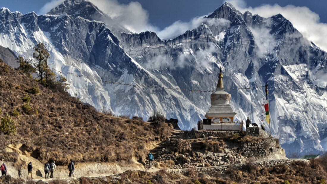
For decades, the Annapurna Circuit Trek has stood as the undisputed holy grail of long-distance hiking. Circumnavigating the entire Annapurna Massif, this historic 14-day journey is a masterclass in geographical, ecological, and cultural diversity. It is widely considered one of the greatest and most visually dynamic trekking routes on the planet, taking you from sweltering, monkey-filled subtropical jungles all the way into the barren, windswept high-altitude deserts that border the Tibetan plateau.
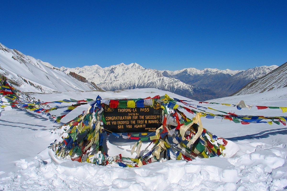
The physical and emotional climax of the trek is the crossing of Thorong La Pass at 5,416 meters (17,769 feet). Standing at the crest of the pass, wrapped in prayer flags and surrounded by towering 7,000 and 8,000-meter peaks, is an achievement that draws thousands of adventurers to Nepal every year.
But the Circuit is about more than just a high pass. It is a journey through two massive river valleys the Marsyangdi and the Kali Gandaki (the deepest gorge in the world). It is a transition from the Hindu farming communities of the lowlands into the ancient Buddhist strongholds of the Manang and Mustang districts.
To help you conquer this legendary route safely and comfortably, the expedition experts at Mountain Treks Nepal have crafted this definitive, encyclopedic operational guide. We break down our meticulously paced 14-day itinerary, detailing exactly what you will encounter each day from the apple orchards of Bhratang to the sacred temples of Muktinath along with the latest 2026 updates on trail conditions, permits, the NATT trails, and altitude safety protocols.
The Geography and Ecology: Four Treks in One
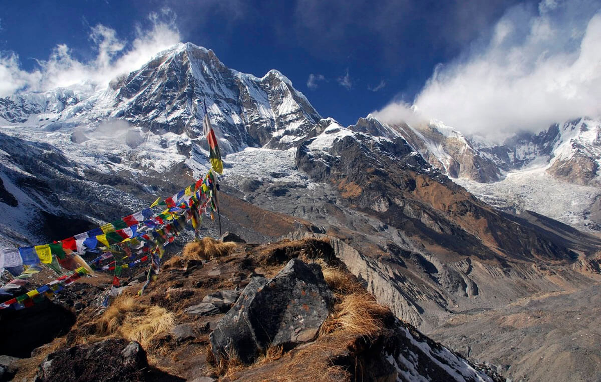
Your 14-day journey traverses the Annapurna Conservation Area Project (ACAP), Nepal’s largest and most biologically diverse protected area. Because the Annapurna massif acts as a colossal weather barrier, the trek is essentially divided into four distinct geographical zones, each with entirely different weather, flora, and fauna.
1. The Subtropical Marsyangdi Valley (800m – 2,000m)
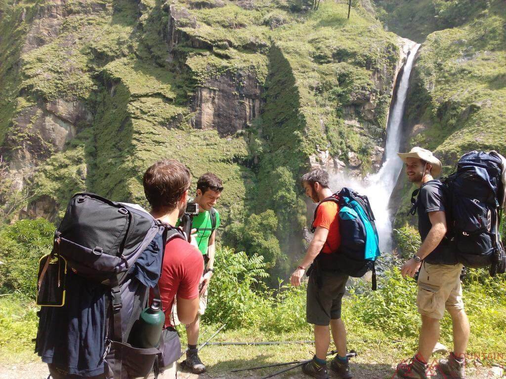
Starting around Besisahar and Syange, the climate is hot, sticky, and intensely humid. The raging Marsyangdi River cuts through steep, lush green hills dotted with terraced rice paddies, millet fields, and magnificent waterfalls plunging directly over the trail. The forests here are dense jungles of bamboo, banana trees, and ferns. You will hear the constant chatter of Rhesus macaques and Langur monkeys swinging through the canopy above you.
2. The Temperate Pine Forests (2,000m – 3,000m)
As you climb past Dharapani and Chame, the jungle is abruptly replaced by fragrant, dark temperate forests of blue pine, silver fir, and rhododendron. The air cools significantly, losing its humidity. It is here that the first massive snow-capped peaks including Mount Manaslu (8,163m) and Annapurna II (7,937m) begin to dominate the skyline above the tree canopy.
3. The Alpine Tundra (3,000m – 4,500m)
Crossing into the Manang Valley past Pisang, the landscape blows wide open. You are in a high U-shaped alpine zone of dry scrub, glacial lakes, and grazing yaks. The massive northern slopes of the Annapurna range form an impenetrable, glaciated wall to your left. The tree line vanishes entirely, replaced by hardy alpine mosses and lichens. This is the domain of the Blue Sheep (Bharal) and the elusive Snow Leopard.
4. The Trans-Himalayan Desert (3,800m – 2,600m)
After crossing Thorong La, you drop sharply into the Kali Gandaki gorge. Because the Annapurna massif blocks the summer monsoon rain from reaching this area, Lower Mustang is a stark “rain shadow.” It is a dry, barren, incredibly windy desert of golden rock, ancient sandstone caves, and whitewashed Tibetan architecture that looks more like the American Southwest than the classic Himalayas.
The Reality of the Road and the NATT Trails

If you have researched the Annapurna Circuit, you have likely heard the controversy: “The road ruined the trek.”
Over the last decade, dirt motor roads have been carved deep into both the Marsyangdi and Kali Gandaki valleys. On the eastern side, jeeps can now drive all the way to Manang (3,540m). On the western side, the road reaches from Beni up through Jomsom and Muktinath.
Walking on a dusty road alongside honking jeeps is not why you came to the Himalayas. However, the trek is far from ruined.
The NATT (New Annapurna Trekking Trails) Solution
To preserve the trekking experience, the Annapurna Conservation Area Project (ACAP) and local communities developed the NATT (New Annapurna Trekking Trails). These are alternative, marked footpaths (marked with red/white or blue/white painted flags on rocks and trees) that deliberately cross the river and route you high into the forests, completely avoiding the dusty motor roads.
When you trek with Mountain Treks Nepal, our expert local guides know exactly where the NATT branches off. We ensure you spend maximum time on ancient trading footpaths, passing through quiet, traditional villages that the road bypassed entirely.
Furthermore, the road provides a massive safety advantage. In the event of severe altitude sickness in Manang or a twisted ankle in Muktinath, ground-based emergency jeep rescues are now possible in hours, rather than relying entirely on weather-dependent helicopters.
How Difficult is the Annapurna Circuit Trek?
The Annapurna Circuit Trek is universally graded as Moderate to Challenging. It does not require ropes, crampons, or technical mountaineering skills, but it is a relentless test of endurance.
The Physical Toll:
You will be walking for 5 to 7 hours a day for two weeks. While the trails are generally well-graded trade routes, there are sections of steep, rocky ascent. The most physically punishing day is the descent from Thorong La Pass to Muktinath, which requires a knee-crushing drop of 1,600 vertical meters in a single afternoon.
The Altitude Factor:
Crossing a 5,416-meter pass is a serious physiological undertaking. At Thorong La, oxygen levels are roughly 50% of what they are at sea level. The trek requires a slow, deliberate pace. Our 14-day itinerary includes a mandatory acclimatization day in Manang (3,540m) to ensure your body builds the red blood cells necessary to survive the thin air.
The Complete 14-Day Annapurna Circuit Itinerary

This is the definitive, day-by-day operational breakdown of the Mountain Treks Nepal 14-Day Annapurna Circuit itinerary, engineered for maximum altitude safety, cultural immersion, and scenic exposure.
Day 1: Arrival in Kathmandu (1,350m)
You will land in Kathmandu, the chaotic, vibrant capital city of Nepal, and this is where your grand Himalayan loop really begins. On arrival at Tribhuvan International Airport, our Mountain Treks Nepal representative will provide a cordial welcome and transfer you via private vehicle to your boutique hotel in Thamel.
Later in the evening, after refreshing, you can wander around Thamel, the buzzing tourist hub filled with gear shops, bakeries, and cultural charm. Kathmandu is rich with UNESCO sites; if time permits, a visit to the Swayambhunath Stupa (Monkey Temple) or Kathmandu Durbar Square offers a perfect introduction to Nepal’s deep heritage. In the evening, you will meet your guide for a comprehensive trek briefing and gear check. Overnight in Kathmandu.
Day 2: Drive to Syange via Besisahar (1,100m)
Drive Time: 7-9 hours
On the second day, you will leave the crowds of Kathmandu behind and set on a scenic overland journey to beautiful Besisahar. The drive follows the winding Trishuli River, cutting across the beautiful countryside featuring terraced farms, busy roadside villages, and deep green valleys.
Besisahar (760m), the headquarters town for the Lamjung district, is the point of beginning for many trekkers preparing to embark on the Annapurna Circuit. Your permits will be checked at the ACAP office here. From Besisahar, the pavement ends. You transfer to a rugged 4WD private local jeep, navigating a thrilling dirt road carved into the gorge to reach Syange, your base for the night. Located on the banks of the Marsyangdi River beneath a towering waterfall, Syange marks the true beginning of your trek through rough trails and shady green landscapes. Overnight at a lodge in Syange.
Day 3: Trek to Dharapani (1,881m)
Walking Time: 6 hours
Today begins early in the morning with a warm breakfast of porridge or eggs. After that, you will head towards Dharapani from Syange. The trek follows the NATT trails to avoid the road, going along rugged-style paths with multiple long steel suspension bridges to cross the roaring Marsyangdi River.
You are rewarded with spectacular views of the steep, verdant hills and deep valleys along the trail. Midday, the valley opens into a wide, flat basin the beautiful village of Tal, where we will have a big lunch. The trail then climbs into fragrant pine forests and terraced fields that complete the slide into transitional shifts and beautiful scenery.
Signs of Buddhist prayer flags, mani walls, and stone chortens become much more prominent near Dharapani, indicating your cultural move toward Tibetan-influenced lands. The village serves as a vital junction (where the Manaslu Circuit joins) and your base for tonight’s stay. Overnight in Dharapani.
Day 4: Trek to Chame (2,725m)
Walking Time: 5-6 hours
The trek to Chame becomes slightly more demanding but is entirely worth the effort. You gain significant elevation today, hiking through thick, dark fir and pine forests and crossing many high mountain streams.
The first major place is Bagarchap, a typical Tibetan-style village where glimpses into hill culture can be appreciated. Further along, the trail passes through Danakyu village, where a steep climb offers you your first truly staggering views of the high peaks, including Annapurna II and Mount Manaslu.
The hike continues through dense forest to the Tamang village of Koto, where you can find a perfect lunch spot with a panoramic view of the Manaslu range. The last stretch brings you to Chame, the bustling administrative headquarters of the Manang District. There are small natural hot springs by the river here to dip your tiredness away while basking in the glorious view of Annapurna II. Overnight in Chame.
Day 5: Trek to Pisang (3,100m)
Walking Time: 5-6 hours
Chame to Pisang is a fascinating trek where the landscapes change dramatically, offering you the diverse views that make the Annapurna Circuit famous. You will start with the crossing of the Marsyangdi River by a suspension bridge, entering the high U-shaped alpine valleys.
The trail cuts through dense pine forests and past expansive, high-altitude apple orchards in the village of Bhratang (famous for fresh apple cider and pastries). Shortly after, the climbing terrain becomes rather dramatic as you face Paungda Danda a massive, 1,500-meter-high curved slab of solid rock dominating the horizon, known locally as the “Gateway to Heaven.”
After crossing a series of suspension bridges, the trail opens into the expansive, arid Pisang Valley. Pisang serves incredible views of the mountains, such as Annapurna II and the glaciated peak of Pisang Peak. You will stay overnight at Pisang at a traditional tea house.
Day 6: Trek to Manang (3,540m)
Walking Time: 5-7 hours
Today offers two route options. Mountain Treks Nepal strongly recommends the “Upper Route” via Ghyaru and Ngawal. Climbing steadily up through a steep ridge, the trail leads you into today’s grand destination, the Manang Valley. This upper trail keeps you high above the valley floor, offering arguably the greatest panoramic views of the entire trek, with the Annapurna range towering directly across from you.
Deepening into the valley brings you into traditional settlements featuring flat-roofed stone houses, massive prayer flags, and prayer wheels that heavily influence Tibetan culture.
Braga, the final phase of this trail before your destination, is a village with a historic 500-year-old monastery perched on a hillside. At the end of the trail, Manang will be reached. This large, prosperous village features several excellent tea houses, bakeries, and gear shops where you can stay overnight and have the best views of the Annapurna range. Overnight in Manang.
Day 7: Acclimatization Day at Manang (3,540m)
Walking Time: 3-4 hours (Acclimatization hike)
Acclimatization Day is an absolute medical necessity once you are above 3,500 meters. Hence, this day will be spent discovering Manang and its nearby destinations as your body builds red blood cells to adjust to this elevation.
Following the “climb high, sleep low” principle, your guide will lead a short hike to nearby sites. A walk up to the Chongkor viewpoint gives an alluring glance of Gangapurna Glacier tumbling down the mountain, and the shining turquoise waters of Gangapurna Lake below. Alternatively, you can hike up to the “100 Rupee Lama” cave to receive a Buddhist blessing for a safe pass crossing.
Manang is also a cultural hub, providing profound insight into the way of life and customs of the Gurung and Tibetan people. You will witness the serenity and get to interact with the locals. You stay overnight at a tea house, resting and hydrating heavily in preparation for the Thorong La Pass ascent.
Day 8: Trek to Yak Kharka (4,090m)
Walking Time: 3-4 hours
From Manang, the trail leaves the Marsyangdi Valley, turning northwest into the Jarsang Khola valley. It leads to Yak Kharka and marks your true entry into the high wilderness of the heavens.
The trail carries on at a gradual, slow pace and opens out to extensive views of barren, windswept landscapes and snow-covered mountain tops. The vegetation dwindles entirely to alpine scrub. From the small settlements, massive shaggy yaks graze as the locals carry on their daily routines, completely blended with the rugged surroundings.
The air begins to thin drastically, signifying the remoteness and raw beauty of this area. Keep your eyes peeled on the steep cliffs for herds of blue sheep (Bharal). You will spend the night at a local tea house in the tiny settlement of Yak Kharka.
Day 9: Trek to Thorong Phedi (4,420m)
Walking Time: 3-4 hours
On the ninth day of the Annapurna Circuit Trek, the adventure from Yak Kharka leads us directly to the lap of Thorong La Pass – Thorong Phedi (which literally means “Base of the Hill”).
The ascent is gradual, passing through the tiny settlement of Ledar, and marked by a few switchbacks and rocky patches laced with alpine meadows and far-off peaks. The place speaks volumes with its rugged beauty, where yaks and other livestock find limited pastures, ensuring a rural touch to the landscape. Before reaching Phedi, you must cross a notorious, landslide-prone scree slope; your guide will ensure you cross this unstable section safely and swiftly.
Now, at Thorong Phedi, nestled in a stark rocky bowl, the snow-covered peaks are visible through the clear surroundings. Night at this altitude is much more challenging due to freezing temperatures that plummet as soon as the sun drops behind the cliffs. You must be prepared with your expedition down jacket and -15°C sleeping bag. Eat a large bowl of garlic soup and rest early for the 3:00 AM start. Overnight in Thorong Phedi.
Day 10: Thorong La Pass (5,416m) to Muktinath (3,800m)
Walking Time: 8-10 hours
Today is the physical climax and trip highlight of the Annapurna circuit, as you will reach the highest point of this trek – Thorong La Pass.
You will wake up at 3:00 AM to face the cold, crisp, freezing mountain dawn. Wearing your headlamp and heavy down jacket, you begin the slow, grueling zigzag climb up the moraine. The well-defined trail is a mental battle of false summits, but taking slow, deliberate steps in the thin air is key.
As the sun rises, illuminating the peaks in gold, the slope levels out. The trail leads to a massive chorten wrapped in thousands of prayer flags that mark the summit Thorong La, at 5,416 meters. As you reach the top of the pass, you will be rewarded with sweeping, panoramic views of the Annapurna and Dhaulagiri ranges stretching into the Mustang region as far as the eye can see.
From the pass, one must descend 1,600 vertical meters to Muktinath following a rugged, incredibly steep, and loose trail. This is punishing on the knees. You finally arrive in Muktinath, a deeply sacred pilgrimage place for both Hindus and Buddhists. It is at this point that the Muktinath Temple, with its sacred 108 water spouts and a burning eternal flame powered by natural gas, symbolizes the spiritual close of an expedition into the heights. This will be a lasting memory in its beautiful surroundings and heavenly significance. Overnight in Muktinath.
Day 11: Trek to Jomsom (2,670m) via Kagbeni
Walking Time: 5-6 hours
On the eleventh day of the Annapurna Circuit Trek, the trip will entail a journey toward Jomsom from Muktinath as a mostly downhill trek into incredible open, arid landscapes. You have officially entered the Trans-Himalayan desert.
The surroundings are dominated by soaring views down into the Kali Gandaki River the deepest gorge in the world, flanked by the 8,000-meter peaks of Dhaulagiri and Annapurna I. As you descend, you will pass across the rural, medieval village of Kagbeni. Its Tibetan-influenced narrow alleys are lined with whitewashed mud-brick houses against seemingly endless backdrops of the Nilgiri peaks. In this traditional village, the old monastery brings an additional mystical touch, and it serves as the gateway to the restricted Upper Mustang region.
From Kagbeni onwards, the trail hugs the wide, rocky bank of the river. By late morning, fierce, howling headwinds funnel up the Kali Gandaki gorge. You must wear sunglasses and a buff to protect your face as you push through the wind, passing through beautiful scenery before arriving in Jomsom. Jomsom is a much bigger town, serving as the administrative hub of Mustang, complete with an airstrip and comfortable lodges. Overnight stay at a lodge in Jomsom.
Day 12: Drive to Pokhara
Drive Time: 7-9 hours (Alternatively, a 25-minute flight)
Today, we will take a local 4WD jeep drive from Jomsom down the Kali Gandaki gorge to Pokhara. The journey itself is a unique, bumpy adventure, passing through scenic landscapes, deep valleys, and the beautiful villages of Marpha (famous for its apple brandy) and Tatopani (where hot springs await).
Pokhara is a beautiful and natural place that feels like returning to paradise after the harsh high altitudes. Checking into your hotel, a boat ride on Phewa Lake, Devi’s Fall, and Gupteshwar Cave are some of the major attractions. Or maybe you want to explore the colorful streets of Lakeside, which are filled with cafes, shops, art galleries, and restaurants serving massive celebratory pizzas and cold beer. Overnight stay at a hotel in Pokhara.
Day 13: Drive to Kathmandu By Tourist Bus
Drive Time: 6-7 hours
Today, you will wake up early in the morning, have a warm breakfast, and show up at a tourist bus station for a 6 to 7 hours ride back to Kathmandu.
The journey takes you on the paved Prithvi Highway through the Tanahun and Dhading Districts, offering you the chance to enjoy the natural sceneries of green terraced fields, lush forests, and the ever-flowing Marsyangdi and Trishuli Rivers.
As you reach Kathmandu, you will be escorted to your respective hotel where you can rest. Or you can go on a final exploration journey in Thamel to shop for souvenirs. In the evening, Mountain Treks Nepal hosts a grand farewell dinner with cultural performances to celebrate your completion of the Annapurna Circuit Trek. Overnight in Kathmandu.
Day 14: Final Departure
On your final day in Nepal, you’ll be transferred to Tribhuvan International Airport approximately three hours before your flight home. You will bid farewell to Nepal and the Mountain Treks Nepal Team, and then finalize your legal formalities before boarding a plane. Although this journey is complete, you will carry the ever-lasting memories of the Annapurna Circuit Trek throughout your life.
Conquering Thorong La Pass (5,416m) and Altitude Safety

The crossing of Thorong La Pass is the ultimate physiological test of the trek. At 5,416 meters, the effective oxygen level is drastically reduced, making Acute Mountain Sickness (AMS) a primary and critical concern.
Understanding AMS
If you ascend faster than your body can adapt, you develop AMS.
-
Mild Symptoms: Headache, nausea, loss of appetite, dizziness, and fatigue.
-
Severe Symptoms (HAPE/HACE): Severe confusion, inability to walk in a straight line (ataxia), extreme lethargy, and a rattling cough with pink sputum. These are fatal emergencies requiring immediate descent.
Mountain Treks Nepal Safety Protocols:
-
Strict Acclimatization: Our itinerary never compromises on altitude safety. The pacing from Chame to Pisang, to Manang, to Yak Kharka strictly adheres to the medical rule of increasing sleeping elevation by no more than 500 meters a day above 3,000 meters. The rest day in Manang (3,540m) is an absolute, non-negotiable medical requirement.
-
Oximeter Monitoring: Our guides carry digital pulse oximeters to check your blood oxygen saturation ($SpO_2$) and resting heart rate twice daily to catch early signs of altitude distress.
-
Hydration: You must drink 4 to 5 liters of water daily. Dehydration is a massive catalyst for AMS in the dry mountain air.
-
Emergency Protocols: If severe AMS symptoms manifest at Thorong Phedi, our guides will initiate an immediate descent. We are equipped with satellite comms to coordinate rapid helicopter evacuations to Kathmandu if medically necessary. Comprehensive travel insurance covering high-altitude trekking is mandatory.
Teahouse Culture: Food, Lodging, and Wi-Fi on the ACT
The Annapurna Circuit features some of the best teahouse infrastructure in the Himalayas, blending rustic mountain charm with surprising culinary diversity due to its history as an ancient trade route.
Accommodation
-
Lower Elevations (Syange, Dharapani, Chame): Teahouses are quite comfortable, often featuring attached bathrooms with hot gas-powered showers.
-
Higher Elevations (Manang to Thorong Phedi): Accommodations become basic and highly utilitarian. Rooms are twin-sharing with uninsulated plywood or stone walls, simple foam mattresses, and zero heating. The communal dining room is the only warm place, heated by a yak-dung or wood stove. You must bring a high-quality sleeping bag.
The Trail Diet
The food is incredibly diverse, designed to provide massive caloric intake for your 6-hour hiking days.
-
Dal Bhat: The staple of Nepal rice, lentil soup, and vegetable curry. It provides massive calories and comes with free, unlimited refills.
-
Trade Route Treats: The ACT is famous for its bakeries. You will find fresh apple pie in Bhratang and Marpha, excellent espresso in Manang, yak burgers, pizza, and pasta.
-
The Meat Warning: Avoid eating meat above Chame. Due to a lack of refrigeration, meat carried to high altitudes is a severe risk for gastrointestinal illness. Stick to a vegetarian diet higher up.
Wi-Fi and Charging
Wi-Fi is available at almost every teahouse along the route (via Everest Link cards or local Ncell mobile data), though the signal weakens significantly at Yak Kharka and Thorong Phedi. Device charging via solar or hydro power is available for a small fee ($2-$4). Bring a 20,000mAh power bank to save money.
Essential Packing List for the Annapurna Circuit
Packing for the ACT requires immense versatility. You must prepare for 30°C (86°F) humid jungle heat in Besisahar and -15°C (5°F) freezing arctic winds at Thorong La Pass, while adhering to a strict 15 kg (33 lbs) porter weight limit.
-
The Layering System: Avoid cotton completely. Pack 3 moisture-wicking synthetic t-shirts for the lowlands. Bring heavy Merino wool base layers, a fleece mid-layer, and a heavy-duty Gore-Tex waterproof/windproof shell (jacket and pants) for the highlands.
-
Extreme Insulation: An expedition-grade heavy down jacket is mandatory for the high camps and the 3:00 AM pass crossing. (Mountain Treks Nepal provides high-quality down jackets as complimentary loaner gear).
-
Sleeping Bag: A genuine four-season down sleeping bag rated to -15°C is essential for Manang, Yak Kharka, and Thorong Phedi. (Also provided as complimentary loaner gear).
-
Footwear: Sturdy, waterproof trekking boots that are fully broken in. Pack lightweight camp shoes (Crocs/sandals) to let your feet breathe in the teahouses.
-
Accessories: A high-lumen headlamp (vital for the dark Thorong La start), category 4 UV wrap-around sunglasses, warm insulated mittens, a Buff (to protect from the Kali Gandaki dust), and flick-lock trekking poles to save your knees on the 1,600m Muktinath descent.
-
Water Purification: Plastic bottles are banned in the ACAP region. Bring two 1-liter Nalgene bottles and water purification tablets (Chlorine Dioxide) or a SteriPen.
Mandatory Permits, Costs, and Regulations
Trekking the Annapurna Circuit requires specific permits and careful logistical management, all of which are handled entirely by Mountain Treks Nepal on your behalf in Kathmandu.
Required Permits (2026 Costs)
As of 2026, you require two primary permits for the standard Annapurna Circuit loop:
-
Annapurna Conservation Area Project (ACAP) Permit: NPR 3,000 (~$22 USD) for foreign nationals.
-
TIMS (Trekkers’ Information Management System) Card: NPR 2,000 (~$15 USD) for foreign nationals.
If you plan to take side trips off the main circuit (such as to the Nar Phu Valley or Upper Mustang), additional expensive Restricted Area Permits are required. The standard circuit to Tilicho Lake, however, is fully covered by the base ACAP/TIMS.
The Mandatory Guide Regulation
Crucial Update: As of April 1, 2023, the Nepal Tourism Board mandated that all foreign trekkers must hire a government-licensed guide affiliated with a registered trekking agency. Independent, solo trekking is no longer legally permitted on the Annapurna Circuit. You will be turned away at the Besisahar checkpoint if you do not have a licensed guide. This rule ensures trekker safety in high-altitude environments and provides vital local employment.
Best Time to Trek the Annapurna Circuit
-
Autumn (Late September to November) — The Gold Standard: The most popular and reliable season. The monsoon washes the dust away, leaving crystal-clear skies and razor-sharp views of the Annapurnas. The weather is highly stable, making the crossing of Thorong La Pass much safer. By November, it is freezing at Thorong Phedi, but visibility is perfect.
-
Spring (March to May) — The Rhododendron Bloom: A spectacular time to trek, highlighted by blooming rhododendron forests in the lower valleys around Chame. The temperatures are warmer, making the high camps slightly more comfortable. However, early March can still see heavy winter snow blocking Thorong La, and afternoon thermal haze is common by May.
-
Winter (Dec–Feb): We do not recommend this trek in deep winter. Extreme cold and heavy snow frequently close Thorong La Pass entirely, trapping trekkers in Manang or forcing them to turn back.
-
Monsoon (June–Aug): Interestingly, because the upper Manang and Mustang valleys sit in a “rain shadow” behind the Annapurna massif, the upper circuit is relatively dry during the summer. However, the lower Marsyangdi valley experiences severe rain, landslides, washed-out roads, and leech infestations, making the approach miserable.
Physical Training: How to Prepare
You will be hiking for 5 to 7 hours a day for two weeks, covering roughly 160 kilometers. You must prepare your body at least 12 weeks before departure.
-
Cardiovascular Endurance (The Aerobic Base): You need a massive aerobic engine. Aim for 3 to 4 sessions a week of running, cycling, or swimming (45 to 60 minutes per session) keeping your heart rate in Zone 2. This trains your body to process oxygen efficiently for the high altitudes.
-
Leg Strength and Rucking: The most specific and effective way to train is climbing stairs or local hills with a weighted backpack. Load a daypack with 7 to 10 kg (15 to 22 lbs) and climb for 1 to 2 hours, twice a week. You must build immense muscular endurance in your calves and quadriceps.
-
Core Strength: A strong core will prevent lower back pain from carrying your daypack day after day. Incorporate planks, deadlifts, and lunges into your routine.
Frequently Asked Questions (FAQs)
How difficult is the Annapurna Circuit compared to Everest Base Camp?
Both treks are graded as “Moderate to Challenging,” but they present different obstacles. Everest Base Camp spends more days at extreme altitude, making the air consistently thinner. The Annapurna Circuit has a wider variety of terrain, more diverse ecological zones, and a much steeper, singular obstacle: the 5,416m Thorong La Pass. The Annapurna Circuit also features a brutal 1,600m descent in a single day (from the pass to Muktinath), which is extremely taxing on the knees.
What is the food like on the Annapurna Circuit?
The food is excellent and diverse. While the staple is traditional Dal Bhat (rice, lentil soup, and vegetable curry), the circuit’s history as a major trade route means you will also find bakeries serving fresh apple pie, yak burgers, pizza, pasta, and excellent coffee.
How cold does it get at Thorong La Pass?
When you begin your ascent from Thorong Phedi at 3:00 AM, temperatures are routinely between -10°C and -15°C (14°F to 5°F), with severe wind chill dropping the “feels like” temperature even lower. You must be equipped with a heavy down jacket, insulated mittens, and thermal layers. By midday, as you descend into Muktinath, the sun warms the desert valley up to 10°C (50°F).
Can I skip the drive from Jomsom to Pokhara?
Yes! The 7-to-9-hour drive down the Kali Gandaki gorge from Jomsom is extremely bumpy and dusty. Many trekkers opt to take the spectacular 25-minute domestic mountain flight from Jomsom directly to Pokhara. This flight must be booked in advance and is subject to early morning weather conditions, as fierce winds ground flights by mid-morning.
Is there an avalanche risk on the trek?
During the standard trekking seasons (Spring and Autumn), avalanche risk on the main circuit is relatively low. However, unseasonal heavy snowfall can create avalanche zones, particularly between Yak Kharka, Thorong Phedi, and the pass itself. In October 2026, unseasonal snows briefly affected the pass, but local teams quickly cleared the trail. Your licensed guide is trained to assess snow stability and weather reports daily.
Complete the Circuit with Mountain Treks Nepal
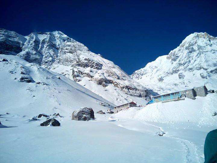
The Annapurna Circuit is a life-defining expedition that tests your physical limits while rewarding you with unparalleled ecological and cultural beauty. From the steamy jungles of the Marsyangdi to the freezing, breathless heights of Thorong La, it is a journey that changes your perspective on the world forever.
However, executing a 14-day expedition over a 5,416-meter pass requires flawless logistics, perfect acclimatization pacing, and a support team you can trust with your life. Don’t leave your grand Himalayan loop to chance.
With over 15 years of remote-expedition excellence, Mountain Treks Nepal guarantees your safety and success. We navigate the NATT trails to keep you off the dusty roads, handle all 2026 permit requirements, provide elite Wilderness First Responder-certified guides, and supply complimentary -15°C sleeping bags and down jackets so you can focus entirely on the majestic trail ahead.
Contact our Kathmandu headquarters today to customize your itinerary, secure your trekking dates for the upcoming season, and start preparing for the ultimate Himalayan adventure.