


Share This:
Complete Guide to the Manaslu Circuit Trek: Nepal’s Best-Kept Secret
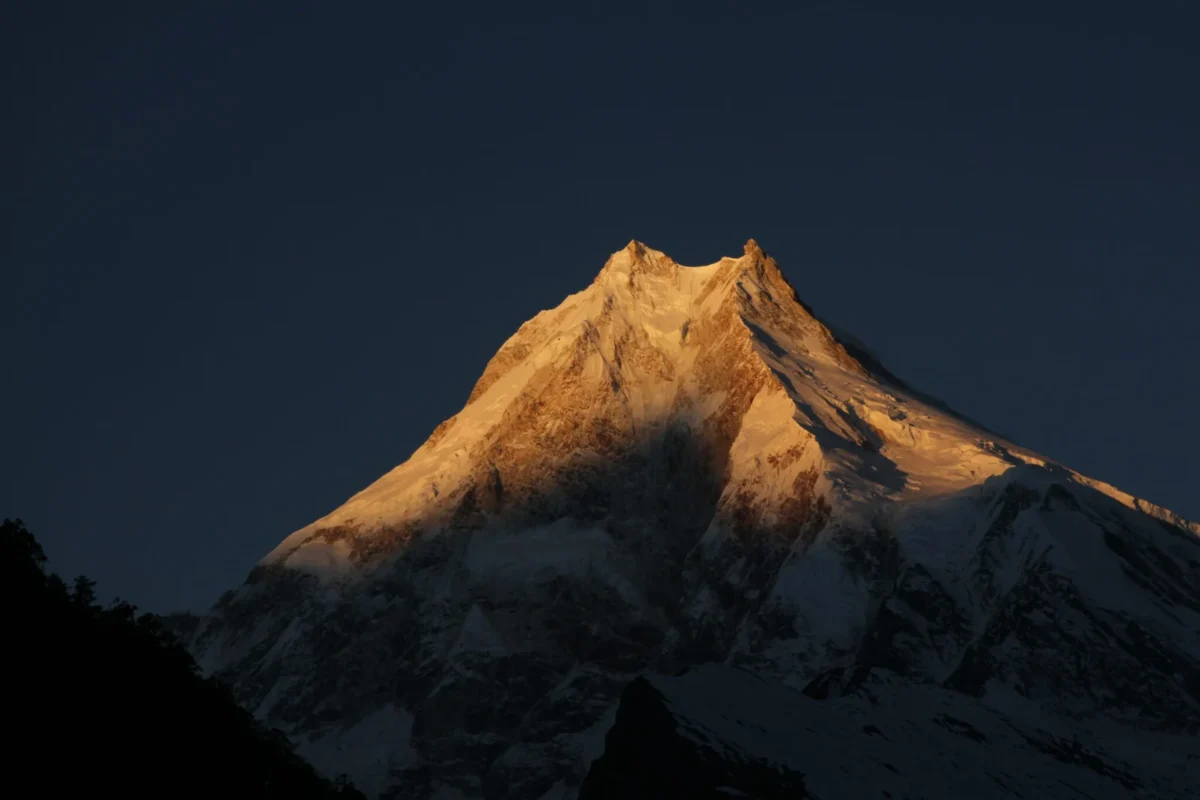
For decades, the Annapurna Circuit held the undisputed title as the greatest long-distance trek in the world. However, as motorized road construction pushed deeper into the Annapurna and Mustang regions, wilderness purists began searching for a new frontier. They found it hidden in the rain shadow of the Himalayas, circling the world’s eighth-highest mountain: Mount Manaslu (8,163 meters / 26,781 feet).
The Manaslu Circuit Trek is a spectacular, 14-to-18-day expedition that circumnavigates the “Mountain of the Spirit.” It is everything the Annapurna Circuit used to be twenty years ago wild, culturally untouched, incredibly remote, and entirely free from heavy motorized traffic once you hit the upper trail. Operating strictly as a restricted area to protect its fragile ecology and ancient Tibetan culture, the Manaslu Circuit requires special government permits and a mandatory licensed guide.
You will hike through the deep, roaring, sub-tropical gorge of the Budhi Gandaki River, transition from Hindu terraced farms into ancient Tibetan Buddhist settlements in the Nubri Valley, and culminate your journey by crossing the formidable, glaciated Larkya La Pass at 5,106 meters (16,752 feet).
This exhaustive, encyclopedic guide is crafted by the high-altitude expedition experts at Mountain Treks Nepal. Whether you are planning your first foray into Nepal’s restricted zones or you are a seasoned Himalayan veteran looking to prepare for your next great challenge, this guide covers absolutely every aspect of the Manaslu Circuit. We meticulously break down the geology, the culture, the rigorous 14-day itinerary, the latest 2026 post-flood trail updates, the strict permit regulations, and the exact gear you need to survive and thrive above 5,000 meters.
The Geography, Geology, and Ecology of the Manaslu Region
To truly appreciate the Manaslu Circuit, one must understand the sheer scale of the landscape you are walking through. The Manaslu Conservation Area Project (MCAP), established in 1998, covers 1,663 square kilometers of the Gorkha District.
The Budhi Gandaki Gorge: A Geological Marvel
For the first week of the trek, you are trapped in a deep, V-shaped gorge carved over millions of years by the Budhi Gandaki River. This river originates from the glaciers of the Tibetan plateau and slices directly through the Himalayan range. The valley walls are so incredibly steep and narrow that in places like Khorlabesi and Tatopani, direct sunlight only hits the trail for a few hours a day. You will cross the river countless times on swaying steel suspension bridges and navigate dramatic cantilever pathways that are pinned directly into the sheer vertical cliff faces.
Flora: From Jungle to Tundra
Because the trek begins at a sweltering 890 meters and peaks above 5,100 meters, it encompasses six distinct climatic zones.
-
Sub-Tropical (Below 1,000m): Around Arughat and Machha Khola, the environment is hot and intensely humid. You will walk through dense jungles of bamboo, banana trees, and ficus. Terraced rice and millet paddies dominate the arable land.
-
Temperate (1,000m – 3,000m): As you climb past Jagat and Deng, the jungle gives way to fragrant broadleaf forests of oak, elm, and rhododendron. In the spring (March-April), these forests erupt into a vibrant canopy of red, pink, and white blossoms.
-
Sub-Alpine (3,000m – 4,000m): Passing Namrung and Lho, you enter ancient forests of blue pine, juniper, and Himalayan birch. The trees grow stunted and twisted due to the harsh, freezing winds.
-
Alpine and Nival (Above 4,000m): Once you pass Sama Gaun, the tree line vanishes entirely. The landscape transforms into a barren, windswept tundra of low scrub, lichens, and mosses, eventually giving way to the stark nival zone of pure rock, snow, and glacial ice at Larkya La.
Fauna: Wildlife in the Conservation Area
Because hunting has been strictly forbidden by the Buddhist inhabitants of the upper valleys for centuries, the wildlife in the Manaslu region is surprisingly abundant and less fearful of humans than in other parts of Nepal.
-
Lower Elevations: You will hear the constant chatter of Rhesus macaques and Langur monkeys in the canopy. The forests are a birdwatcher’s paradise, home to the Danphe (the colorful Himalayan Monal, Nepal’s national bird).
-
Higher Elevations: Above 3,500 meters, the true masters of the mountain appear. Herds of Blue Sheep (Bharal) and Himalayan Tahr are frequently spotted grazing on the impossibly steep cliffs around Samdo.
-
The Apex Predator: The Manaslu Conservation Area is prime habitat for the highly endangered Snow Leopard. While sightings are exceptionally rare due to their elusive nature and perfect camouflage, their tracks are often found in the snow near Dharamsala.
History and The Nubri Culture
The Manaslu region is not just a geographical wonderland; it is a living museum of ancient Himalayan anthropology. As you ascend the Budhi Gandaki, you journey through three distinct cultural zones.
The Lower Valleys (Gurung and Magar)
Around Machha Khola and Jagat, the culture is predominantly Hindu. The residents are primarily of the Gurung, Magar, and Brahmin castes. The architecture consists of mud-brick and stone houses with thatched or tin roofs. The daily rhythm is dictated by the agricultural cycles of planting and harvesting rice and maize on the steep terraced hillsides.
The Kutang Region
Around the village of Deng, the cultural shift begins. You enter the Kutang region. The architecture changes to robust stone houses with wooden shingles weighed down by heavy rocks to withstand the wind. Hindu shrines are gradually replaced by Buddhist chortens. The people here practice a unique syncretic form of religion, blending Tibetan Buddhism with ancient animist Bon traditions.
The Nubri Valley (Little Tibet)
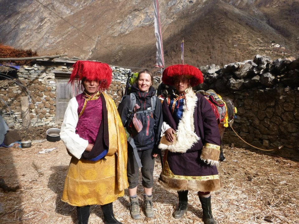
From Namrung upwards to Samdo, you enter the Nubri Valley. This world feels entirely Tibetan. The residents are descendants of Tibetan immigrants who crossed the high passes centuries ago to settle in these hidden valleys.
-
Tibetan Buddhism: Buddhism is the absolute rule of law here. The landscape is adorned with towering, intricately carved mani walls (stones etched with the mantra Om Mani Padme Hum). You will pass centuries-old monasteries (Gompas) like the Ribung Gompa in Lho, where young monks train.
-
Daily Life: The locals dress in traditional chubas (thick, wraparound woolen coats). Agriculture is limited to hardy crops like barley and potatoes. The economy is heavily reliant on the massive herds of yaks, which provide milk, butter (for the ubiquitous Tibetan butter tea), wool, and transportation.
Why Choose the Manaslu Circuit over Everest or Annapurna?
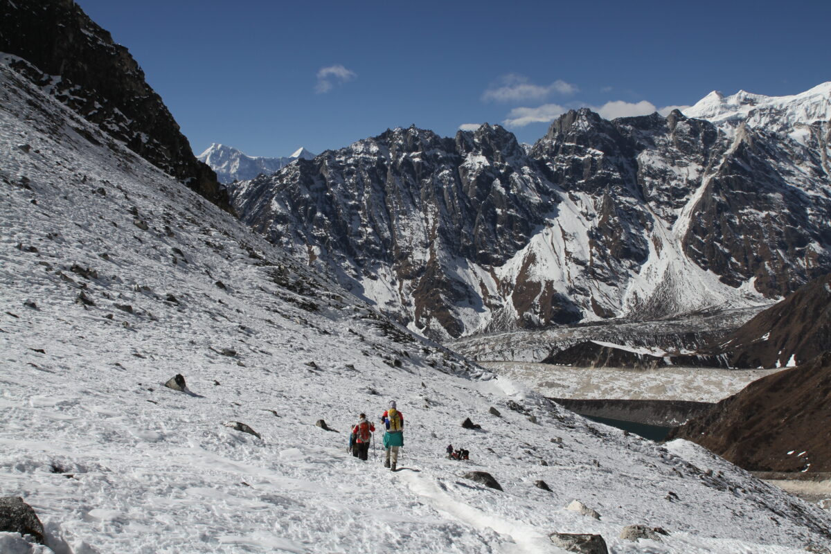
If you are torn between Nepal’s “Big Three” treks, here is why Manaslu often wins the hearts of veteran trekkers.
-
The Crowd Factor: In 2023, the Everest and Annapurna regions saw tens of thousands of trekkers. Manaslu, regulated by strict restricted area permits, sees a tiny fraction of that number. You will not have to fight for a bed in a teahouse, wait in lines to cross suspension bridges, or walk in a constant convoy of other tourist groups.
-
Lack of Roads: The Annapurna Circuit has been heavily altered by a jeep road that now runs almost the entire length of the Marsyangdi and Kali Gandaki valleys. While there is road construction slowly creeping up the lower Budhi Gandaki gorge (currently reaching near Machha Khola), the vast majority of the Manaslu Circuit remains a pure, untouched footpath inaccessible to vehicles.
-
Cultural Preservation: Because Everest is so commercialized, traditional Sherpa culture has adapted heavily to western tourism. In Manaslu, tourism is a secondary income. When you walk through Lho or Sama Gaun, you are witnessing an authentic, working Tibetan community that operates exactly as it has for hundreds of years.
-
The Challenge: The Manaslu Circuit is arguably harder than the Annapurna Circuit. The lower gorge features intense “Nepali Flat” (relentless steep ups and downs), and crossing Larkya La (5,106m) requires exceptional stamina. It is a badge of honor for serious hikers.
Important 2026 Trail Updates (Post-Flood Conditions)
Trekking in the Himalayas is always subject to the whims of nature. It is crucial to have the most up-to-date information before planning your expedition.
In early October 2026, a severe flash flood struck the Budhi Gandaki River valley in the Gorkha district, causing significant damage to the lower approach of the Manaslu Circuit. As of late October 2026, here is the verified status of the trail:
-
Is the trail open? Yes. The Trekking Agencies’ Association of Nepal (TAAN) and the Manaslu Conservation Area Project (MCAP) confirmed that the Manaslu Circuit has officially reopened for the Autumn 2026 trekking season.
-
Road Access: The off-road track from Arughat to Machha Khola has been restored. The Bailey bridge at Arughat is functional, allowing private 4WD jeeps to transport trekkers directly to the Machha Khola trailhead.
-
Trail Repairs: Local communities have aggressively rebuilt the damaged sections. The trail from Machha Khola to Jagat (which saw heavy damage around Tatopani and Yaru Bagar) is passable via newly cut alternative paths and temporary log bridges.
-
The Upper Trail (Namrung to Larkya La): Everything from Namrung onward including Lho, Sama Gaun, Samdo, Dharamsala, Larkya La Pass, and the descent to Bimthang is completely intact and unaffected by the floods.
-
What this means for you: You can absolutely trek the Manaslu Circuit in 2026 and 2027. However, you must be mentally prepared for rougher walking conditions on the first three days in the lower gorge. The temporary trails require sure-footedness and patience. Partnering with a reputable agency like Mountain Treks Nepal ensures you have an expert local guide who knows the exact status of the daily river crossings.
The Definitive 14-Day Manaslu Circuit Itinerary (Day-by-Day Breakdown)
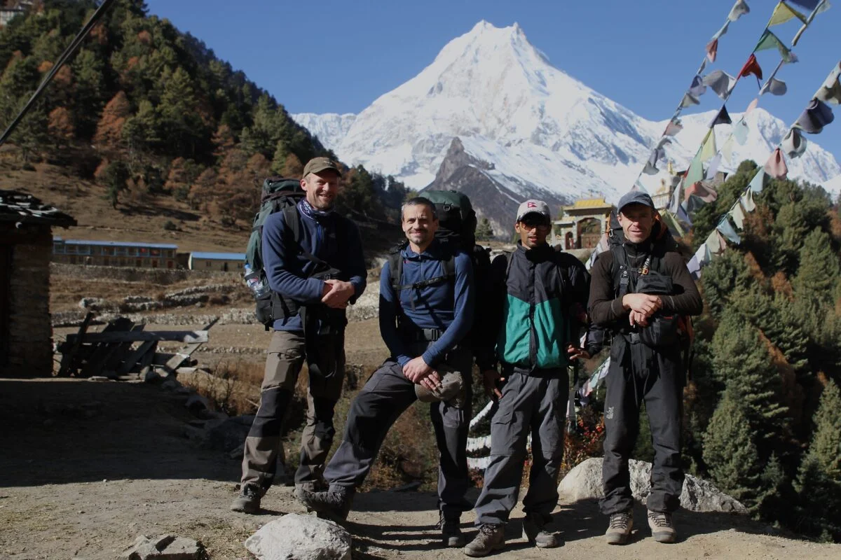
This is the exact, field-tested operational itinerary utilized by Mountain Treks Nepal. It is specifically engineered to balance strenuous physical exertion with the crucial physiological need for high-altitude acclimatization.
Day 1: Arrival in Kathmandu (1,350m / 4,428 ft)
Your Himalayan expedition begins the moment your flight touches down at Tribhuvan International Airport in Kathmandu. As you step out of the terminal into the chaotic, vibrant energy of Nepal’s capital, a representative from Mountain Treks Nepal will be waiting with a traditional marigold garland to welcome you.
You will be transferred via a private, air-conditioned vehicle to your boutique hotel in Thamel, the historic tourist hub of the city. After checking in, you can take a hot shower and shake off the jet lag.
At 5:00 PM, you will meet your lead trekking guide and the expedition manager at our headquarters. This briefing is critical. We will review the 14-day itinerary, verify your travel insurance, and collect your original passports to finalize the processing of your Restricted Area Permits (RAP). Your guide will also conduct a rigorous gear check. If you are missing a -20°C sleeping bag, high-altitude down jacket, or microspikes, we will arrange for you to rent or purchase them immediately in Thamel.
In the evening, enjoy a welcome dinner at a traditional Nepali restaurant, experiencing your first taste of authentic Dal Bhat and local cultural dances. Overnight in Kathmandu.
Day 2: Drive from Kathmandu to Machha Khola via Arughat (890m / 2,920 ft)
Drive Time: 7 to 9 hours
Distance: ~160 km
Today involves no trekking, but it is one of the most physically taxing travel days of the trip. After an early 6:30 AM breakfast, you board a rugged, private 4WD Jeep.
The journey begins smoothly on the paved Prithvi Highway, following the winding, green waters of the Trishuli River. You pass through vibrant roadside towns, observing the daily life of rural Nepal farmers tending to terraced fields, colorful trucks rumbling past, and massive suspension bridges connecting steep hillsides.
After roughly 4 hours, you reach Dhading Besi and then turn towards Arughat Bazar. Arughat is a major trading hub situated on the banks of the Budhi Gandaki River. Here, the pavement abruptly ends. For the next 3 to 4 hours, your jeep will navigate a heavily rutted, rocky, and often muddy off-road track carved directly into the side of the gorge. It is a bone-rattling drive, but the scenery is spectacular. You pass spectacular waterfalls and small Gurung settlements.
Finally, in the late afternoon, the road ends at the quiet riverbank village of Machha Khola (Fish River). You check into your first mountain teahouse, enjoy a hot cup of masala tea, and listen to the roar of the river. Overnight at a lodge in Machha Khola.
Day 3: Trek from Machha Khola to Jagat (1,410m / 4,625 ft)
Walking Time: 6 to 7 hours
Elevation Gain: +520m
After a hearty breakfast of porridge or eggs, you finally lace up your trekking boots. The hike begins by navigating a narrow trail that clings to the steep, humid valley walls of the Budhi Gandaki gorge. The air is thick, and the vegetation is intensely green and sub-tropical.
The morning involves a lot of “Nepali Flat” (steep climbs followed by immediate descents). You pass through the small settlement of Khorlabesi and soon arrive at Tatopani (Hot Water), where hot water cascades from a stone spout in the center of the village. The trail then climbs over another ridge before dropping to cross the Budhi Gandaki River on a massive, swaying suspension bridge.
The afternoon requires intense focus. You will navigate sections of the trail that have been literally blasted into the sheer cliff sides spectacular cantilever pathways suspended over the rushing rapids below. Eventually, the tight, claustrophobic V-shaped valley opens up slightly, and you arrive at the beautiful village of Jagat.
Jagat is stunning. It is known for its immaculately clean, traditional flagstone-paved streets and beautiful stone houses. Crucially, Jagat is the location of the Manaslu Conservation Area Project (MCAP) and Police checkpoint. Your guide will present your Restricted Area Permits to the authorities while you rest. Overnight in a cozy teahouse in Jagat.
Day 4: Trek from Jagat to Deng (1,860m / 6,102 ft)
Walking Time: 6 to 7 hours
Elevation Gain: +450m
Leaving Jagat, the trail climbs over a rocky ridge to Salleri, offering great views of the Sringi Himal (7,187m) to the north. You descend to Sirdibas, a traditional Buddhist village where you will see your first significant clusters of prayer flags and mani walls.
You cross the river again on a massive, long suspension bridge to reach Philim, a large, prosperous Gurung village that serves as the headquarters for the region’s Japanese-funded school. After Philim, the trail traverses a spectacular, highly exposed hillside through golden fields of millet and wheat.
The gorge narrows drastically. You walk through dense, dark forests of bamboo and rhododendron. The trail hugs the cliff wall, descending to the riverbed before climbing steeply back up. You cross the Budhi Gandaki three times today, moving from the east bank to the west bank and back again.
As you approach the village of Deng, you officially cross a cultural threshold. You are entering the Kutang region. The Hindu shrines disappear, replaced entirely by Tibetan Buddhist architecture. Deng is a small, idyllic village perched on a slope, offering a profound sense of isolation. Overnight at a tea house in Deng.
Day 5: Trek from Deng to Namrung (2,630m / 8,628 ft)
Walking Time: 6 to 7 hours
Elevation Gain: +770m
Today is a strenuous day of climbing, but the cultural and ecological rewards are immense. Leaving Deng, the trail drops to the river, crosses it, and then climbs steeply on a well-crafted stone staircase.
You pass through the village of Rana and head towards Bihi Phedi. The trail winds through incredibly dense, quiet forests of fir, rhododendron, and oak. You will likely spot playful Langur monkeys crashing through the canopy above you. The forest floor is carpeted with moss and wildflowers.
By midday, you reach Ghap, a beautiful village adorned with intricately carved mani walls. Here, your guide will teach you the mandatory local custom of always walking to the left (clockwise) of mani walls and chortens to show respect to the Buddhist deities.
After Ghap, you face a brutal, steep, two-hour ascent through the forest. As your legs begin to burn, the trees suddenly break, and you arrive at the sprawling settlement of Namrung. Namrung is the official entry point into the upper Nubri Valley. It features a police checkpoint for your final permit verification. From your lodge in Namrung, you will be treated to spectacular, close-up views of Siring, Ganesh Himal, and the surrounding peaks. The air here is noticeably colder and thinner. Overnight in Namrung.
Day 6: Trek from Namrung to Lho (3,150m / 10,334 ft)
Walking Time: 4 to 5 hours
Elevation Gain: +520m
As you leave Namrung and ascend past the 3,000-meter mark, the sub-tropical world is entirely behind you. The dense broadleaf forests thin out into stunted alpine pine and juniper. The air becomes crisp and dry.
You pass through the Tibetan-style villages of Lihi and Sho. The architecture here is striking flat-roofed stone houses surrounded by expansive fields of barley. You will see locals dressed in traditional chubas (thick woolen coats) tending to massive, shaggy yaks.
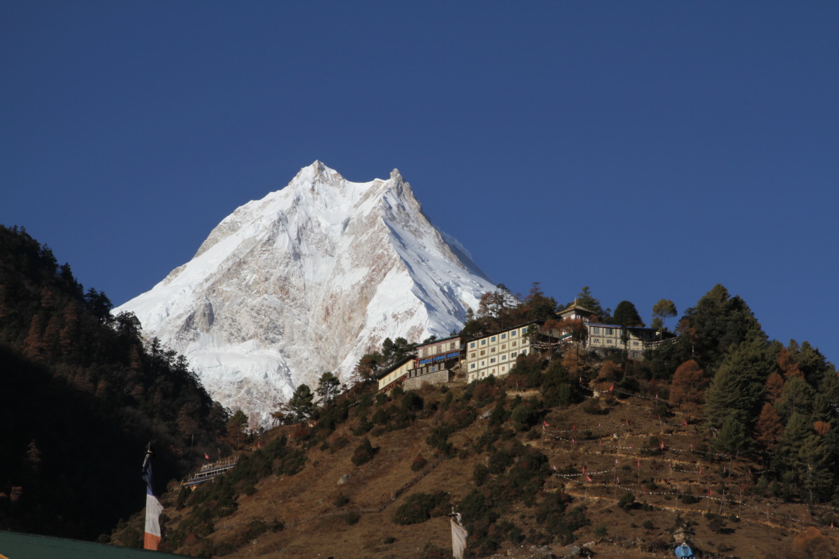
Suddenly, as you round a bend past Sho, the valley opens up, and you get your first staggering, unobstructed view of the twin peaks of Mount Manaslu (8,163m) and Manaslu North. The sight of the world’s eighth-highest mountain dominating the entire western skyline is a moment you will never forget.
You arrive in Lho early in the afternoon. Lho is a spectacular, traditional village characterized by the magnificent Ribung Gompa (monastery) sitting on the hill above the town. Hundreds of young monks live and study here. Take the afternoon to hike up to the monastery, spin the massive prayer wheels, and drink in the silence while gazing at the great mountains. Overnight in Lho.
Day 7: Trek from Lho to Sama Gaun (3,500m / 11,482 ft)
Walking Time: 4 to 5 hours
Elevation Gain: +350m
Today’s hike is a visual feast and relatively gentle, allowing your body to adapt to the altitude. Leaving Lho, you descend into a deep gorge, cross a small glacial stream, and begin a steady, slow climb through a beautiful pine forest.
You emerge from the forest into Shyala, a small village that feels like it is situated in the center of an alpine amphitheater. You have 360-degree views of towering peaks: Himal Chuli and Peak 29 to the left, Manaslu directly ahead, and the snow-capped Kutang Himal to the right.
Continuing up the wide, barren valley, you cross a large plateau and arrive at Sama Gaun (Sama Village), the largest and most important settlement in the Nubri Valley. Sama Gaun is a cultural melting pot and the administrative hub of the upper region. It features impressive Gompas, massive yak herds, extensive stone walls, and a bustling community of traders and mountaineers. It is the perfect place to unwind, roam the ancient alleyways, and acclimatize. Overnight in Sama Gaun.
Day 8: Mandatory Acclimatization Day in Sama Gaun (3,500m)
Walking Time: 4 to 6 hours (Acclimatization hike)
At 3,500 meters, the effective oxygen level in the air is roughly 65% of what it is at sea level. Taking a rest day here is medically imperative to prevent Acute Mountain Sickness (AMS). However, in mountaineering, “rest” means “active acclimatization.” You must adhere to the principle of “climb high, sleep low.”
Your guide will offer several options for the day based on your energy levels:
-
Birendra Tal (The Glacial Lake): A highly recommended, moderate 2-hour round-trip hike to a stunning, turquoise glacial lake situated directly at the base of the Manaslu glacier. You can watch massive chunks of ice calve off the glacier and crash into the freezing waters.
-
Pungyen Gompa: A strenuous 5-to-6-hour round-trip hike up a hidden side valley to a 400-year-old monastery situated on a sweeping plateau. The views of Manaslu’s east face from here are unparalleled, but the altitude gain is significant.
-
Manaslu Base Camp (4,800m): For the incredibly fit, a grueling 8-hour round-trip hike to the actual base camp used by expedition climbers. This is a massive physical undertaking that will fully test your altitude readiness.
After the hike, return to Sama Gaun to explore the village’s main monastery (Kargyu Chholing Gompa), observe traditional Tibetan life, hydrate heavily, and let your body adapt to the thin air. Overnight in Sama Gaun.
Day 9: Trek from Sama Gaun to Samdo (3,860m / 12,664 ft)
Walking Time: 3 to 4 hours
Elevation Gain: +360m
Today is a short, soulful, and highly scenic journey. Leaving Sama Gaun, you follow the Budhi Gandaki River, which has now shrunk from a roaring torrent into a small, braided glacial stream.
You trek across lush, wide alpine meadows. The tree line is completely behind you; the landscape is now a barren, windswept tundra of low scrub, rocks, and grazing yaks. The path is gentle and flanks the towering peaks of the Manaslu massif. You will pass long, beautifully constructed mani walls.
After a few hours, you cross a wooden bridge and make a short, steep climb to arrive at Samdo. Samdo is the highest permanent settlement in the valley. It is an ancient trading post sitting just a day’s walk from the Lajyung La pass (which leads directly into Tibet). The village is deeply influenced by its proximity to the border, and you will often see Tibetan merchants trading Chinese goods. The short trekking day allows for further crucial acclimatization. Spend the afternoon hiking up the ridge behind the village to trigger red blood cell production. Overnight in Samdo.
Day 10: Trek from Samdo to Dharamsala / Larkya Phedi (4,450m / 14,599 ft)
Walking Time: 4 to 5 hours
Elevation Gain: +590m
The path climbs higher and higher, leaving civilization entirely behind. You are walking through wild, savage terrain, tracing the old salt trade route to Tibet.
You descend briefly to cross the Budhi Gandaki on a wooden bridge for the final time. The trail then ascends steadily up the valley. The incline is not overly steep, but the lack of oxygen (now below 60% of sea-level normal) makes every single step feel heavy and labored. You will walk past the ruins of Larkya Bazaar, an ancient seasonal trading market.
You cross a few high-altitude streams and navigate rocky, glacial moraines until you reach Dharamsala, also known as Larkya Phedi (Base of Larkya). This is not a village; it is a seasonal high camp built specifically to stage trekkers for the pass crossing. The landscape is desolate, lunar, and highly exposed to the wind. The accommodations here are extremely basic spartan stone shelters or canvas tents. The temperatures drop sharply to well below freezing once the sun sets. Eat a massive bowl of garlic soup (known to aid acclimatization), pack your daypack, fill your Nalgene bottles with boiling water, and rest early. Tomorrow is the biggest day of your life. Overnight in Dharamsala.
Day 11: Trek from Dharamsala to Bimthang (3,855m) via Larkya La Pass (5,106m / 16,752 ft)
Walking Time: 8 to 10 hours
Elevation Profile: +656m Ascent / -1,251m Descent
The Crux Day. This is the physical and emotional climax of the expedition. You will be woken up by your guide at 3:30 AM. It is freezing, often dropping to -15°C (5°F) with a severe wind chill. You strap on your headlamp, pull on your heavy down jacket, force down a bowl of porridge, and step out into the dark.
The climb begins immediately up a ridge and onto the lateral moraine of the Larkya Glacier. The ascent is long, relentless, and exhausting. The terrain is a mix of loose rock, scree, and icy patches. You must walk at a painfully slow, deliberate pace the “Himalayan Rest Step” to conserve energy and manage your heart rate in the oxygen-starved air.
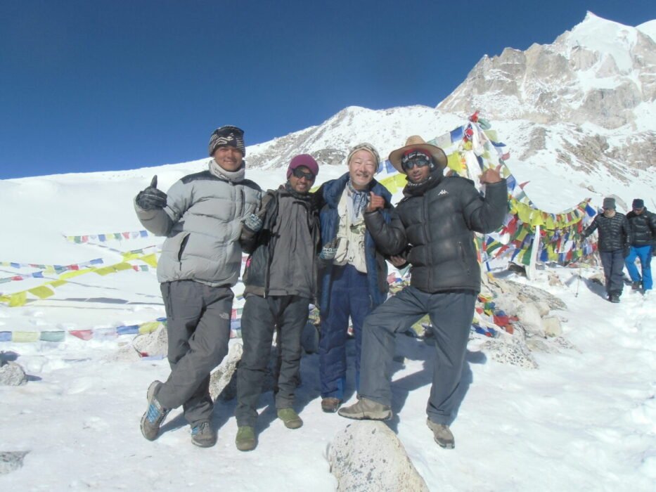
As the sun rises, the agonizing climb is rewarded with spectacular views of Cho Danda and Larkya Peak. You pass several frozen, turquoise glacial lakes. Finally, after 4 to 5 hours of grueling effort, the slope levels out. You see the traditional Buddhist prayer flags fluttering violently in the fierce wind. You have reached Larkya La Pass at 5,106 meters.
The sweeping 360-degree panorama from the summit is beyond words. You are surrounded by a wall of Himalayan giants: Himlung Himal (7,126m), Cheo Himal (6,820m), Kang Guru (6,981m), and the massive, dominating pyramid of Annapurna II (7,937m).
After 20 minutes of celebrating, taking photos, and letting the immense achievement sink in, you must begin the descent. The trail down from Larkya La to Bimthang is arguably harder than the climb. It is incredibly steep, loose, and frequently slippery with hard-packed ice and scree (this is where your microspikes are essential). It is a punishing, knee-jarring 1,200-meter drop.
You eventually drop below the snowline, returning to beautiful, grassy alpine meadows, and arrive at the welcoming, cozy lodges of Bimthang. Bimthang is nestled in a deep, forested valley surrounded on all sides by glaciers. You will be physically shattered, but mentally triumphant. Overnight in Bimthang.
Day 12: Trek from Bimthang to Dharapani (1,963m / 6,440 ft)
Walking Time: 6 to 8 hours
Elevation Loss: -1,892m
After the barren, freezing heights of the pass, today feels like a rebirth into a world of vibrant color, warmth, and thick, oxygen-rich air. The trail from Bimthang descends rapidly, plunging back into dense, lush forests of rhododendron, pine, and oak.
You walk alongside the roaring Dudh Khola (Milk River), passing through the colorful, traditional villages of Kharche, Gho, and Tilje. The landscape transitions back to terraced agricultural fields and wooded hills. The air grows warmer with every passing hour, and you can finally pack your down jacket away.
After passing through the Gurung village of Tilje, you cross a large suspension bridge and arrive in Dharapani. This bustling village sits on the famous Annapurna Circuit trail. You have officially exited the restricted Manaslu area and entered the Annapurna Conservation Area. Dharapani boasts modern amenities, hot gas showers, bakeries, and a lively atmosphere to celebrate the completion of the walking portion of the trek. Overnight in Dharapani.
Day 13: Drive from Dharapani to Kathmandu
Drive Time: 8 to 10 hours
Distance: ~210 km
Today, you say goodbye to the trekking trails and begin the long journey back to civilization. You board a local 4WD Jeep for a rugged, bumpy drive down the steep, dusty mountain road that follows the Marsyangdi River.
The drive down the gorge to the large town of Besisahar takes about 3 to 4 hours. From Besisahar, the dirt road ends, and you transfer to a comfortable private vehicle (or tourist bus) and hit the paved Prithvi Highway. You follow the Trishuli River back towards the Kathmandu Valley, watching the rural landscapes of Nepal pass by.
Upon reaching Kathmandu in the late afternoon, you are escorted back to your hotel in Thamel. After checking in, take a long, luxurious, and much-deserved hot shower. In the evening, Mountain Treks Nepal hosts a grand farewell dinner at a traditional Nepali restaurant. We will celebrate your monumental achievement with excellent food, cultural performances, and the presentation of your trek completion certificate. Overnight in Kathmandu.
Day 14: Final Departure from Nepal
Your 14-day Himalayan adventure comes to a close. Enjoy a final breakfast at your hotel and spend the morning doing some last-minute souvenir shopping in Thamel buying pashminas, singing bowls, or Ghurka knives for friends back home.
A representative from Mountain Treks Nepal will escort you to Tribhuvan International Airport approximately three hours before your scheduled international flight. We will ensure you complete all legal formalities before boarding your flight home. You leave Nepal carrying a profound sense of achievement, a deeper understanding of the mountains, and memories that will last a lifetime.
Crossing Larkya La Pass (5,106m) and Altitude Safety
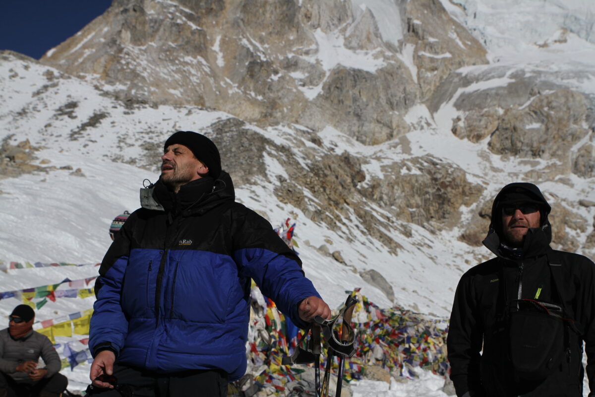
The physical and medical crux of the Manaslu Circuit is crossing Larkya La Pass. It is critical to understand the science of high altitude to ensure your survival and success.
Understanding Acute Mountain Sickness (AMS)
At 5,100 meters, the barometric pressure is roughly half of what it is at sea level. This means every breath you take contains 50% fewer oxygen molecules. Your body adapts to this extreme hypoxia by increasing your respiratory rate, elevating your resting heart rate, and signaling your kidneys to produce erythropoietin (EPO), which stimulates the production of red blood cells.
If you ascend faster than your body can adapt, you develop Acute Mountain Sickness (AMS).
-
Mild Symptoms: Headache, nausea, loss of appetite, dizziness, and fatigue.
-
Severe Symptoms (HACE/HAPE): Loss of physical coordination (ataxia), confusion, severe vomiting, a rattling cough, and pink frothy sputum. High Altitude Cerebral Edema (HACE) and High Altitude Pulmonary Edema (HAPE) are fatal if not treated by immediate descent.
Mountain Treks Nepal Safety Protocols
We do not take chances with altitude. Our 14-day itinerary is medically optimized.
-
Mandatory Acclimatization: We enforce the rest day in Sama Gaun (3,500m). This adheres to the CDC guideline of never increasing your sleeping elevation by more than 500 meters per day once above 3,000 meters.
-
Daily Pulse Oximetry: Our government-licensed, wilderness first-aid-certified guides carry digital pulse oximeters. Every morning and evening, we measure your blood oxygen saturation ($SpO_2$) and resting heart rate. A sudden drop in $SpO_2$ combined with a high pulse is an early warning sign of AMS.
-
Hydration: Dehydration thickens the blood, severely hindering acclimatization. You must drink 4 to 5 liters of purified water daily.
-
Prophylactic Medication: Many travel physicians recommend taking Acetazolamide (Diamox) starting 24 hours before you reach 3,000 meters to speed up the acclimatization process.
-
Helicopter Evacuation: In the rare event of a severe medical emergency (HAPE/HACE) at Sama Gaun, Samdo, or Bimthang, our guides are equipped with satellite communication to coordinate an immediate helicopter medical evacuation directly to a hospital in Kathmandu. This is why comprehensive high-altitude travel insurance is non-negotiable.
Mandatory Permits, Costs, and the 2-Person Rule (2026 Updates)
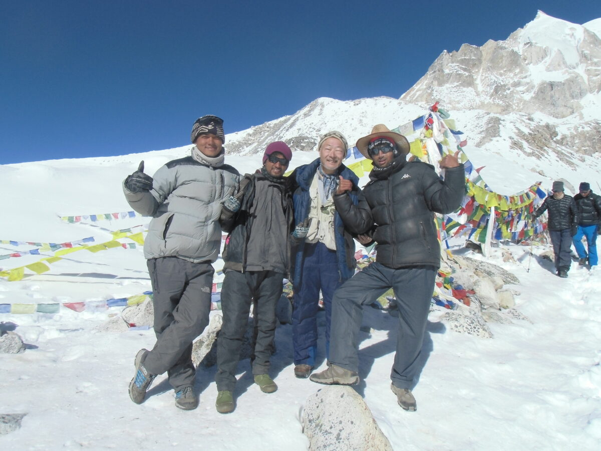
The Manaslu region is a Restricted Area, governed by strict Department of Immigration laws to protect the Tibetan border and preserve the local ecology. You cannot simply buy a ticket and walk.
The 2-Person Minimum Rule
Independent, solo trekking is highly illegal on the Manaslu Circuit. The Nepal government mandates that a Manaslu Restricted Area Permit (RAP) will only be issued to a minimum of two foreign trekkers applying together. Furthermore, they must be accompanied by a government-licensed Nepali guide registered to an authorized trekking agency.
(Note: If you are a solo traveler, Mountain Treks Nepal can successfully pair you with another group departing on the same date, or arrange a legal “ghost permit” to satisfy the government requirement).
Required Permits and 2026 Costs
When you book a package with Mountain Treks Nepal, our operations team handles all filings, passport copies, and payments on your behalf in Kathmandu. Here is the exact breakdown of the 2026 government fees:
-
Manaslu Restricted Area Permit (RAP):
-
Autumn (Sept–Nov): $100 USD for the first 7 days, plus $15 USD for each additional day.
-
Spring/Winter (Dec–Aug): $75 USD for the first 7 days, plus $10 USD for each additional day.
-
Validity: Required from the checkpoint in Jagat until you cross the pass into Dharapani.
-
-
Manaslu Conservation Area Project (MCAP) Permit: NPR 3,000 (approx. $25 USD). Valid for the entire duration.
-
Annapurna Conservation Area Project (ACAP) Permit: NPR 3,000 (approx. $25 USD). Required because the exit route from Dharapani to Besisahar crosses into the Annapurna region.
-
Local Chumnubri Rural Municipality Fee: NPR 1,000 (approx. $8 USD). A local tax that goes directly to infrastructure and schooling in the upper villages.
Teahouse Culture: Food, Lodging, and Surviving Off the Grid

The Manaslu Circuit is developing, but it remains vastly more rustic and authentic than the highly commercialized Everest Base Camp or Annapurna trails.
Accommodation (Where You Sleep)
You will stay in “Teahouses” small, family-run mountain lodges.
-
Lower Elevations (Machha Khola to Namrung): Teahouses here are relatively comfortable. Rooms are typically twin-sharing with wooden beds and thin foam mattresses. You may find attached bathrooms with western-style toilets and hot gas-powered showers (for a small fee of $3-$5).
-
High Elevations (Lho to Dharamsala): As you ascend into the Nubri valley, accommodations become highly spartan. Rooms are constructed of uninsulated plywood or stone. Bathrooms are shared, outdoor squat toilets. The rooms are freezing at night. The only heated space in the entire building is the communal dining room, warmed in the evenings by a central wood or yak-dung burning stove. At Dharamsala (Base Camp), you may sleep in semi-permanent stone dormitories or heavy canvas tents.
Food and Nutrition (What You Eat)
Because there are no roads in the upper valley, all food is either grown locally (potatoes, barley, greens) or carried up by mule trains and porters. The menu is surprisingly diverse but highly carbohydrate-focused.
-
Dal Bhat: The undisputed king of the Himalayas. A massive plate of steamed white rice, lentil soup (dal), vegetable curry (tarkari), and spicy pickles (achar). It is highly nutritious, filling, and comes with unlimited free refills.
-
Tibetan Cuisine: In the upper villages, you will eat excellent Sherpa stew (Syakpa), Tibetan flatbread, Momos (dumplings), and Tsampa (roasted barley flour).
-
Western Options: Most lodges offer basic pasta, fried noodles (chow mein), pancakes, porridge, and eggs.
-
The Meat Warning: Never eat meat above Namrung. There are no refrigerators in the upper Nubri valley. Any chicken or yak meat served in a high camp has been sitting at room temperature for days. Adhere to a strict vegetarian diet to avoid severe gastrointestinal illness on the trail.
Electricity and Wi-Fi
-
Wi-Fi: Available in many villages (usually via prepaid Everest Link satellite cards for $5-$10). However, the signal is notoriously unreliable due to the deep gorge topography and weather interference. Expect to be largely off the grid.
-
Charging: Electricity is generated by small, local solar panels. Charging your phone or camera battery costs money (usually $3-$5 per device) and is entirely dependent on sunny weather. You must bring a high-capacity (20,000mAh+) power bank and store it inside your sleeping bag at night so the freezing temperatures do not drain the lithium-ion batteries.
Physical Training: How to Prepare for the Manaslu Circuit
The Manaslu Circuit is not a walk in the park. You will be hiking for 5 to 8 hours a day, covering roughly 160 kilometers, while carrying a daypack and dealing with 50% less oxygen. You must prepare your body at least 12 weeks before departure.
-
Cardiovascular Endurance (The Aerobic Base): You need a massive aerobic engine. Aim for 3 to 4 sessions a week of running, cycling, or swimming (45 to 60 minutes per session) keeping your heart rate in Zone 2 (conversational pace). This trains your body to process oxygen efficiently.
-
Leg Strength and Rucking: The most specific and effective way to train for Manaslu is stair climbing with a weighted backpack. Load a backpack with 7 to 10 kg (15 to 22 lbs) and climb the tallest stadium, hill, or Stairmaster available to you for 1 to 2 hours, twice a week. You must build immense muscular endurance in your calves, glutes, and quadriceps to handle the steep ascents.
-
Core and Back Strength: A strong core will prevent lower back pain from carrying your daypack for 14 consecutive days. Incorporate planks, deadlifts, and lunges into your routine.
-
The Mental Game: Prepare yourself for discomfort. You will be cold, you will be exhausted, and you will miss your soft bed. Mental resilience the ability to take one more step in the freezing dark on the way up Larkya La is what truly separates successful trekkers from the rest.
The Ultimate Gear and Packing List

Packing for Manaslu requires meticulous planning. You must pack for 30°C (86°F) humid jungle heat along the Budhi Gandaki, and -15°C (5°F) freezing arctic winds at Larkya La Pass, all while adhering to a strict 15 kg (33 lbs) weight limit for the porters.
(Note: When you book with Mountain Treks Nepal, we provide you with a heavy-duty waterproof duffel bag for the porter to carry. You will only carry a 25-30L daypack with your water, camera, rain jacket, and valuables).
The Alpine Layering System (Zero Cotton)
-
Base Layers: 3 moisture-wicking synthetic or Merino wool short-sleeve shirts for the hot lowlands. 2 pairs of heavy-weight Merino wool thermal tops and bottoms (250g) dedicated exclusively for higher camps and sleeping. No cotton. Cotton absorbs sweat, freezes in the cold air, and causes hypothermia.
-
Mid Layers: 1 lightweight grid fleece for active hiking in cold air, and 1 heavier Polartec fleece or synthetic insulated jacket (like a Patagonia Nano Air) for evenings.
-
Outer Shell: 1 heavy-duty, waterproof, and windproof jacket (Gore-Tex 3-layer) with pit zips for ventilation, and 1 pair of waterproof rain pants. Windchill is your biggest enemy on the pass.
-
Heavy Down Jacket: A 700 to 800+ fill-power expedition down parka with an insulated hood. This is your primary survival piece for evenings in unheated dining rooms and the 3:30 AM start for Larkya La. (Mountain Treks Nepal provides high-quality down jackets as complimentary loaner gear).
Footwear and Traction
-
Trekking Boots: Broken-in, high-cut waterproof boots with rigid ankle support and deep Vibram soles. Do not buy new boots the week before your trek; blisters will ruin your trip.
-
Camp Shoes: Lightweight sneakers or Crocs to let your feet air out and breathe around the teahouse lodges.
-
Trekking Socks: 4 pairs of cushioned Merino wool hiking socks and 2 pairs of heavy expedition-weight thermal wool socks reserved strictly for summit day and sleeping.
-
Microspikes (Slip-on Crampons): Mandatory. The descent from Larkya La Pass to Bimthang is incredibly steep and frequently covered in packed snow and dangerous black ice. Slip-on traction spikes will prevent catastrophic falls.
Hardware and Sleeping Gear
-
Four-Season Sleeping Bag (-15°C to -20°C Comfort Rating): Do not skimp on this. Teahouse bedrooms at Dharamsala and Samdo are freezing, and lodge blankets are scarce. (Mountain Treks Nepal provides high-quality -20°C loaner sleeping bags to all clients).
-
Trekking Poles (Flick-Lock): Non-negotiable for Manaslu. They protect your knee joints during the grueling 1,400-meter descent from Larkya La and provide essential balance on loose glacial scree.
-
Water Purification System: Plastic water bottles are banned in the MCAP region to protect the environment. Carry two 1-liter wide-mouth Nalgene bottles. Use chlorine dioxide tablets (Micropur) or a hollow-fiber filter (Sawyer Squeeze) to purify all drinking water. At night, have the lodge fill your Nalgene with boiling water to use as a personal bed warmer inside your sleeping bag.
-
Headlamp (300+ Lumens): With spare lithium batteries (lithium performs much better in the cold than alkaline). Essential for the pre-dawn crossing of Larkya La and navigating unlit teahouses at night.
Best Time to Trek the Manaslu Circuit
The Manaslu Circuit is highly seasonal. Choosing the right window dictates your safety, your views, and your overall experience.
1. Autumn (Late September to Late November) — The Gold Standard
Autumn is universally recognized as the absolute best time for Manaslu.
-
Weather: By late September, the summer monsoon retreats, washing the dust from the sky and leaving behind pristine, hyper-stable atmospheric conditions.
-
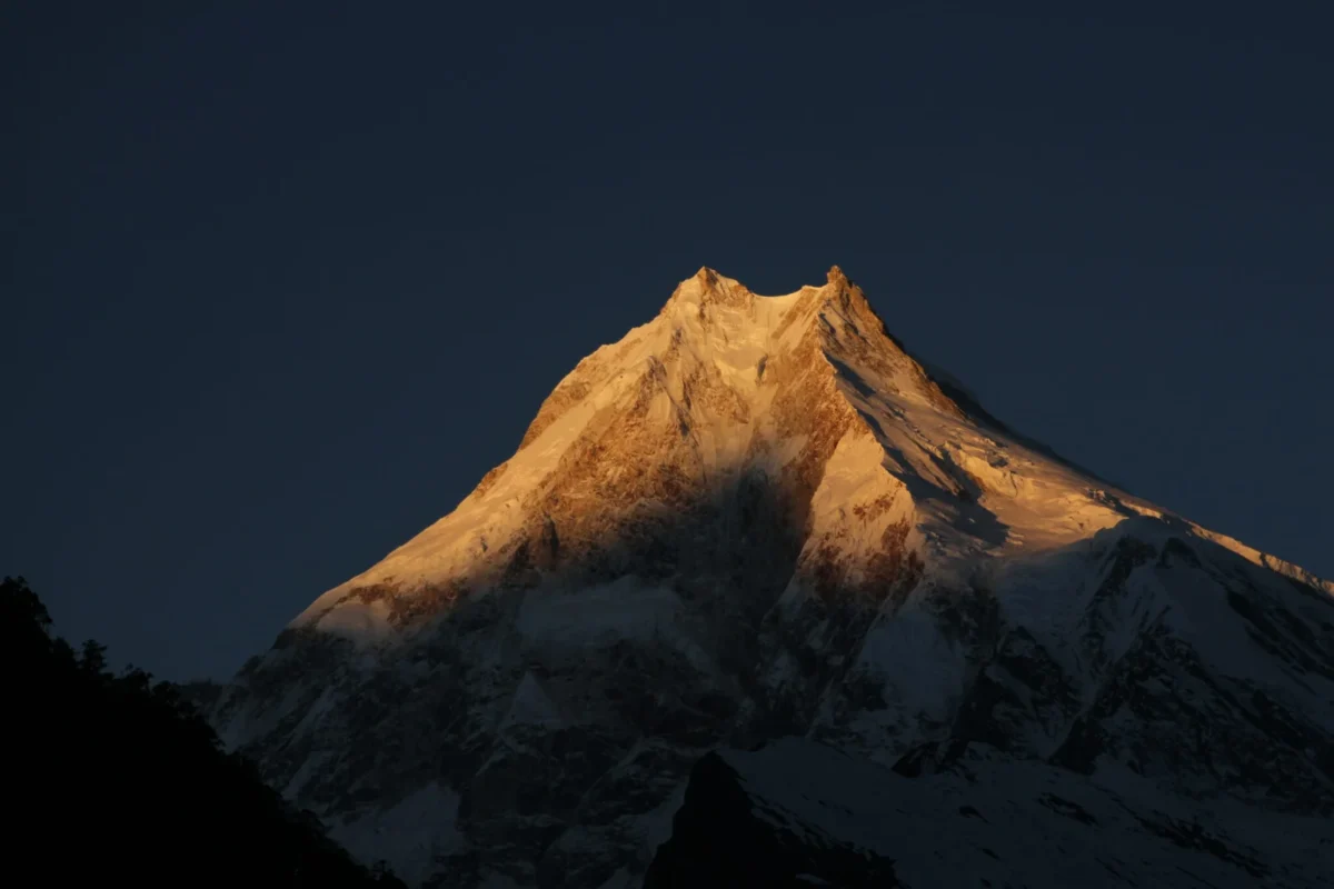
Visibility: You will enjoy crystal-clear, razor-sharp mountain panoramas of Manaslu day after day.
-
Trail Conditions: Trails are dry, rivers are receding, and Larkya La pass is generally free of deep, fresh snow until late November.
-
Temperatures: Daytime hiking temperatures are comfortable (10°C to 18°C in lowlands; 0°C to 5°C at Samdo). Nighttime temperatures drop significantly by November (-10°C to -15°C at Dharamsala).
2. Spring (Late March to May) — The Floral Spectacle
Spring is the second premier window, bringing vibrant color and warming temperatures.
-
Flora & Fauna: The lower and subalpine forests between Deng and Namrung erupt into a breathtaking sea of blooming red, pink, and white rhododendrons. Wildlife activity peaks during this window.
-
Temperatures: Days are noticeably warmer, making the 6-hour hikes comfortable and the teahouses less freezing at night.
-
Considerations: Early spring (March) often holds deep residual winter snow on Larkya La, requiring microspikes and experienced route-finding. By May, rising heat and humidity in the lowlands can create afternoon cloud buildups and haze that obscure distant peaks, though mornings remain crystal clear.
3. Winter (December to February) & Monsoon (June to August)
-
Winter: We strongly discourage trekking Manaslu in winter. Extreme cold (-30°C) and heavy snowfall routinely bury Larkya La Pass, rendering it completely impassable and highly prone to avalanches. Many teahouse owners lock up and migrate to Kathmandu for the winter, leaving you without food or shelter.
-
Monsoon: Do not trek in the summer. The Budhi Gandaki gorge becomes a terrifying trap of severe landslides, washed-out bridges, constant torrential rain, zero mountain visibility, and trails infested with blood-sucking leeches.
Frequently Asked Questions (FAQs)
1. How much does a guided Manaslu Circuit Trek cost?
A standard, all-inclusive 14-day package typically ranges from $1,000 to $1,400 USD per person. This price includes your Kathmandu hotels, 4WD jeep transport, highly expensive Restricted Area Permits, a licensed English-speaking guide, porters (1 for every 2 trekkers), and three meals a day with teahouse accommodation on the trail.
2. What happens if I get sick and cannot cross Larkya La?
If you develop severe Acute Mountain Sickness (AMS) at Samdo or Dharamsala, safety is our absolute priority. You cannot push over the pass. Your guide will initiate an immediate descent back down the valley. If you are incapacitated, our guides will use emergency communication to dispatch a rescue helicopter from Kathmandu to evacuate you to a hospital.
3. Do I need to tip my guide and porter?
Yes. Tipping is a deeply ingrained part of the trekking culture in Nepal and forms a significant part of a guide and porter’s income. A general rule of thumb is to tip 10% to 15% of your total trek cost, pooled together by the trekking group and distributed on the final night in Dharapani or Kathmandu (typically 60% to the guide, 40% split among the porters).
4. Is the water safe to drink on the trail?
Absolutely not. You must never drink untreated tap water or stream water in Nepal. Because single-use plastic bottles are banned in the conservation area, you must carry your own reusable bottles (Nalgene) and treat all water with purification tablets or a high-quality filter before drinking.
5. Can a beginner do the Manaslu Circuit?
“Beginner” refers to trekking experience, not fitness. If you have never hiked before, Manaslu is not the place to start. You should have prior experience with multi-day hiking, camping, and basic wilderness survival. You must be in excellent cardiovascular shape. Ambitious, highly fit beginners can complete this trek, provided they train rigorously for 3 months prior and strictly follow their guide’s acclimatization pacing.
Trek the Restricted Region with Mountain Treks Nepal
The Manaslu Circuit Trek is not just a vacation; it is a life-defining expedition into one of the most culturally profound and ecologically spectacular regions on planet Earth. Standing face-to-face with an 8,000-meter giant in pure, uncrowded silence is a privilege reserved for those willing to embrace the physical struggle.
However, executing a 14-day expedition in a restricted area requires flawless logistics. Navigating the complex RAP permits, managing the rugged 4WD transport to Machha Khola, and ensuring your safety over a 5,106m glaciated pass demands expertise you can trust with your life.
With over 15 years of remote-expedition excellence, Mountain Treks Nepal guarantees your safety, comfort, and success. We provide elite, government-licensed Sherpa guides trained in wilderness first-aid and pulse oximetry. We handle every bureaucratic detail and supply complimentary -20°C sleeping bags and down jackets so you can focus entirely on the trail ahead.
The 14-Day Manaslu Circuit Trek with Mountain Treks Nepal features flexible daily departures customized to your group’s schedule during the prime Himalayan trekking windows.
Explore Manaslu Circuit pricing and dates
Departure Dates
-
Spring: Daily departures are available from March through May.
-
Autumn: Daily departures are available from September through December.
Package Costs
Pricing is tiered based on the total number of trekkers in your group. These rates reflect a current promotional discount off the standard $1,285 base price:
| Group Size | Price Per Person (USD) |
| 1 Person | $1,095 |
| 2 – 6 Persons | $995 |
| 6 – 15 Persons | $955 |
The package covers your airport transfers, two nights of twin-sharing hotel accommodation in Kathmandu with breakfast, teahouse lodging along the route, three meals a day (breakfast, lunch, and dinner) during the trek, and the services of an experienced guide. Hiring a dedicated porter to carry your heavy gear is optional and costs an additional $300 for the duration of the trek (carrying up to 25 kg).
Permit Requirements
Yes, all required government and restricted area permits are fully included in the package cost when you book the 14-Day Manaslu Circuit Trek with Mountain Treks Nepal. We handle all the paperwork, passport submissions, and fee processing on your behalf in Kathmandu before you hit the trail.
Because Manaslu is a heavily protected border region, it requires a complex set of four distinct permits. Here is exactly what is required (and covered in your package):
-
Manaslu Restricted Area Permit (RAP): This is a special immigration permit required to enter the upper Nubri Valley (from Jagat to Dharapani). The government charges $100 USD for the first 7 days during the Autumn season (Sept–Nov) and $75 USD during the Spring/Winter (Dec–Aug).
-
Manaslu Conservation Area Project (MCAP) Permit: Required to enter the protected conservation zone, costing NPR 3,000 (approx. $25).
-
Annapurna Conservation Area Project (ACAP) Permit: Because the trek crosses Larkya La Pass and exits the mountains through Dharapani (which sits inside the Annapurna region), you are also required to have an Annapurna permit, costing NPR 3,000 (approx. $25).
-
Tsum Nubri Rural Municipality Fee: A local municipal tax of NPR 1,000 (approx. $8) that goes directly toward maintaining local infrastructure and schools in the high-altitude villages.
Important Permit Regulation:
The Nepal Department of Immigration strictly enforces a “2-Person Minimum Rule” for the Manaslu Restricted Area Permit. You cannot trek solo. If you are traveling alone, Mountain Treks Nepal will pair you with other trekkers departing on the same date so that the permit requirements are legally met.