



Share This:
14-Day Manaslu Circuit Trek Itinerary: Nepal’s Best-Kept Secret
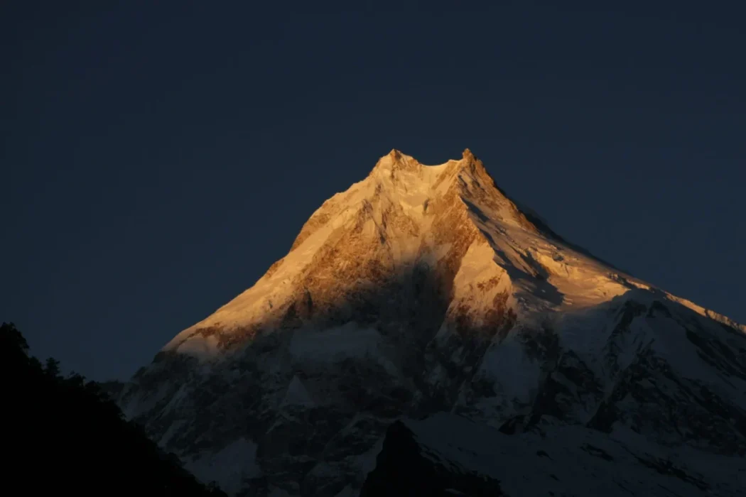
For decades, the Annapurna Circuit held the undisputed title as the greatest long-distance trek in the world. However, as road construction pushed deeper into the Annapurna region, wilderness purists began searching for a new frontier. They found it in the shadow of the world’s eighth-highest mountain: Mount Manaslu (8,163 meters / 26,781 feet).
The Manaslu Circuit Trek is a spectacular, 14-day Manaslu Circuit Trek itinerary expedition that circumnavigates the “Mountain of the Spirit.” It is everything the Annapurna Circuit used to be 20 years ago wild, culturally untouched, incredibly remote, and entirely free from motorized traffic once you hit the trail.
Operating strictly as a restricted area to protect its fragile ecology and ancient Tibetan culture, the Manaslu Circuit requires special government permits and a mandatory licensed guide. You will hike through the deep, roaring gorge of the Budhi Gandaki River, transition from Hindu terraced farms into ancient Tibetan Buddhist settlements in the Nubri Valley, and culminate your journey by crossing the formidable, glaciated Larkya La Pass at 5,106 meters (16,752 feet).
This exhaustive, 3,000-word guide is crafted by the expedition experts at Mountain Treks Nepal. We meticulously break down our expertly paced 14-day itinerary, detailing exactly what you will encounter each day, how to navigate the strict permit regulations, and how to safely conquer one of the Himalayas’ most rewarding high-altitude passes.
Why the Manaslu Circuit is the “New Annapurna”?
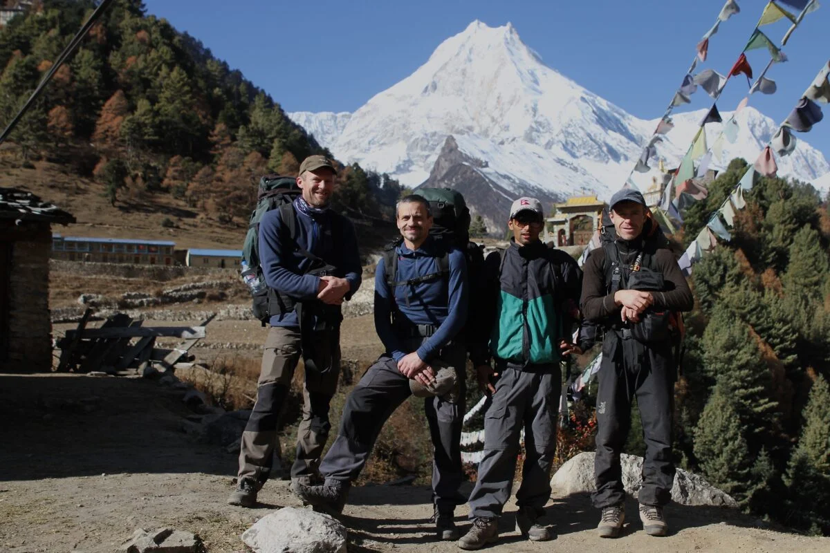
The Manaslu Circuit has rapidly become the trek of choice for seasoned hikers looking for an authentic Himalayan experience.
-
Uncrowded Trails: Because of the restricted area permit regulations and the ban on independent solo trekking, Manaslu sees a mere fraction of the foot traffic that floods the Everest and Annapurna regions. You can hike for hours enjoying pure mountain silence.
-
Dramatic Topographical Variety: The trek begins at a sweltering 890 meters and peaks above 5,100 meters. You will walk through humid bamboo jungles, dense pine forests, and barren alpine tundra in a single two-week span.
-
Untouched Culture: The upper reaches of the trek specifically around Lho, Sama Gaun, and Samdo border Tibet. The Nubri culture here is deeply preserved. You will pass centuries-old monasteries, massive mani walls, and locals dressed in traditional chubas herding yaks.
-
The Perfect Circuit: Like all great trekking circuits, you rarely walk the same path twice. The journey continuously propels you forward into new valleys, ending in the lush Annapurna region at Dharapani.
Geography and Culture: The Budhi Gandaki to the Nubri Valley
The trek is defined by the Budhi Gandaki River. For the first week, you are trapped in a deep, V-shaped gorge carved by this roaring river. The valley walls are so steep that sunlight often only hits the trail for a few hours a day. You will cross the river countless times on swaying suspension bridges and dramatic cantilever pathways pinned directly into the sheer cliff faces.
As you ascend, you journey through three distinct cultural zones:
-
The Lower Valleys (Gurung and Magar): Around Machha Khola and Jagat, the culture is predominantly Hindu, characterized by terraced rice and millet farming.
-
The Kutang Region: Around Deng, the cultural shift begins. The architecture changes to stone houses with wooden shingles, and Buddhist prayer flags begin to appear.
-
The Nubri Valley: From Namrung upwards, you enter a world that feels entirely Tibetan. The residents are descendants of Tibetan immigrants who crossed the high passes centuries ago. Buddhism is the absolute rule of law here; hunting is strictly forbidden, making wildlife incredibly tame.
How Difficult is the Manaslu Circuit Trek?

The Manaslu Circuit Trek is universally graded as Strenuous / Challenging. It requires immense physical stamina, strong knees, and mental grit.
The Trail Conditions: The lower gorge is infamous for its “Nepali flats” a relentless series of steep ascents and descents that eventually lead nowhere but exhaust your quadriceps. The trail is often rocky, narrow, and prone to landslides during the monsoon, requiring careful, deliberate footwork.
The Pass (Larkya La): While not technical (you do not need ropes or ice axes), crossing Larkya La (5,106m) is a grueling test of endurance. It requires a pre-dawn alpine start in freezing temperatures and a 9-to-10-hour day of sustained walking through thin air, followed by a punishing, knee-jarring 1,400-meter descent into Bimthang.
Altitude: You will spend five consecutive nights above 3,000 meters and cross the 5,000-meter mark. Acute Mountain Sickness (AMS) is a primary concern, which is why our 14-day itinerary includes a mandatory acclimatization rest day in Sama Gaun.
The Complete 14-Day Manaslu Circuit Trek Itinerary
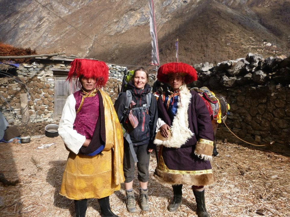
This is the definitive, day-by-day operational breakdown of the Mountain Treks Nepal 14-Day Manaslu Circuit itinerary, engineered for maximum altitude safety, cultural immersion, and scenic exposure.
Day 1: Arrival in Kathmandu (1,350m / 4,428 ft)
Your Himalayan adventure begins the moment you touch down at Tribhuvan International Airport. A representative from Mountain Treks Nepal will meet you and transfer you via private vehicle to your hotel in the bustling tourist district of Thamel.
After checking in, you can freshen up and unwind after your long international flight. In the evening, we will host a comprehensive trek briefing. We will introduce you to your licensed guide, review the day-by-day plan, verify your restricted area permits, and check your gear to ensure you are fully prepared for the mountains. You can spend the rest of the evening exploring the lively streets of Thamel or resting. Overnight in Kathmandu.
Day 2: Drive from Kathmandu to Machhi Khola via Arughat Bazar (890m / 2,920 ft)
Drive Time: 7-9 hours From picturesque Kathmandu, the real adventure begins. Today involves no trekking, but it is one of the most rugged travel days of the trip. You will board a private 4WD Jeep and drive out of the Kathmandu Valley, following the winding Trishuli River through lush, green countryside and terraced hills.
After about 4 hours on paved roads, you reach Arughat Bazar, a bustling trading hub. Here, the pavement ends. The vehicle transitions onto a rugged, bumpy, off-road mountain track that follows the Budhi Gandaki River deeper into the gorge. The drive offers an unfiltered insight into rural Nepalese life. After hours of bone-rattling but incredibly scenic driving, the road ends at the quiet riverbank village of Machha Khola. You check into a local lodge, enjoying the tranquil sounds of the river. Overnight at Machha Khola.
Day 3: Trek to Jagat (1,410m / 4,625 ft)
Walking Time: 6-7 hours On the second day of the Manaslu Circuit, you finally lace up your boots. The hike begins by navigating a narrow trail that clings to the steep valley walls. You will pass the natural hot springs at Tatopani and cross your first massive suspension bridges over the churning Budhi Gandaki River.
The trail occasionally makes high ascents over the river, providing spectacular views of the magnificent, deep gorge. You will navigate sections of trail that are literally blasted into the sheer cliff sides (cantilever bridges). Eventually, the tight V-shaped valley opens up slightly, and you arrive at the beautiful village of Jagat. Jagat is known for its immaculately clean, traditional stone-paved streets. It is also the location of the Manaslu Conservation Area Project (MCAP) checkpoint, where your permits will be verified. Overnight in Jagat.
Day 4: Trek to Deng (1,860m / 6,102 ft)
Walking Time: 6-7 hours Leaving Jagat, you continue up the valley through terraced hillsides dotted with small Gurung settlements like Philim. The gorge narrows significantly today, and you will cross the Budhi Gandaki several times on suspension bridges surrounded by phenomenal landscapes and lush bamboo and rhododendron vegetation.
The trail features several steep, taxing climbs, known locally as “Nepali flat.” As you approach the village of Deng, you officially enter the Kutang region. The cultural shift is palpable; Hindu shrines are replaced by Buddhist chortens. Deng is a small, idyllic village where you will catch your first amazing glimpses of the snow-capped Shringi Himal. Overnight at a tea house in Deng.
Day 5: Trek to Namrung (2,630m / 8,628 ft)
Walking Time: 6-7 hours Today’s trail runs alongside the river, leading you deeper into the ancient Buddhist world. You will pass through Ghap, a beautiful village adorned with intricately carved mani walls (stones carved with Buddhist mantras) and fluttering prayer flags. Your guide will teach you the local custom of always walking to the left of mani walls and chortens to show respect.
After Ghap, the trail climbs steeply through dense, quiet forests of fir, rhododendron, and oak. You will likely spot playful Langur monkeys in the canopy. The steep ascent concludes at Namrung, a bustling settlement and the official entry point into the upper Nubri Valley. Namrung features a police checkpoint for your Restricted Area Permits. From your lodge, you will be treated to spectacular, close-up views of Siring, Ganesh Himal, and the surrounding peaks. Overnight in Namrung.
Day 6: Trek to Lho (3,150m / 10,334 ft)
Walking Time: 4-5 hours As you leave Namrung and ascend past the 3,000-meter mark, the world of high alpine landscapes opens up. The dense forests thin out, and the air becomes noticeably cooler and crisper.
You pass through the villages of Lihi and Sho, where traditional Tibetan dress (chubas) is common. Suddenly, the valley opens up, and you get your first staggering, unobstructed view of the twin peaks of Mount Manaslu and Manaslu North. The sight of the world’s eighth-highest mountain dominating the skyline is breathtaking. You arrive in Lho, a typical Tibetan-style village characterized by flat-roofed stone houses and the magnificent Ribung Gompa (monastery) sitting on the hill above town. It is a perfect place to drink in the silence and gaze at the great mountains. Overnight in Lho.
Day 7: Trek to Sama Gaun (3,500m / 11,482 ft)
Walking Time: 4-5 hours Today’s hike is a visual feast. The trail ascends gently, offering panoramic views of the Kutang Himal to the northeast and the magnificent, heavily glaciated eastern face of Manaslu to the southwest.
You will pass through Shyala, a village surrounded by 360-degree views of towering peaks, feeling as though you are standing in an alpine amphitheater. Continuing up the wide, barren valley, you arrive at Sama Gaun, the largest and most important village in the Nubri Valley. Sama Gaun is a cultural melting pot, featuring impressive Gompas, massive yak herds, and extensive stone walls. It is the perfect place to unwind, roam the ancient alleyways, and acclimatize. Overnight in Sama Gaun.
Day 8: Acclimatization Day in Sama Gaun (3,500m)
Walking Time: 4-6 hours (Acclimatization hike) At 3,500 meters, taking a rest day is medically imperative to prevent Acute Mountain Sickness (AMS). However, “rest” at high altitude means “active acclimatization.”
Your guide will offer several options for the day. A popular choice is a hike to Birendra Tal, a stunning turquoise glacial lake situated directly at the base of the Manaslu glacier. For those with more energy, a grueling hike up to Pungyen Gompa or even Manaslu Base Camp (4,800m) offers incredible views and excellent altitude conditioning. After the hike, return to Sama Gaun to explore the village’s monasteries, observe traditional Tibetan life, and let your body adapt to the thin air. Overnight in Sama Gaun.
Day 9: Trek to Samdo (3,860m / 12,664 ft)
Walking Time: 3-4 hours Today is a short but soulful journey. Leaving Sama Gaun, you follow the Budhi Gandaki River, which has now shrunk to a small glacial stream. You trek across lush alpine meadows and move up a gentle, wide path flanked by towering peaks. The tree line is completely behind you, replaced by barren, windswept tundra.
You arrive at Samdo, the highest permanent settlement in the valley, sitting less than a day’s walk from the Lajyung La pass leading into Tibet. Samdo is a traditional village deeply influenced by its proximity to the border, known for its trading history. The short trekking day allows for further acclimatization and a chance to interact with the locals. Overnight in Samdo.
Day 10: Trek to Dharamsala / Larkya Phedi (4,450m / 14,599 ft)
Walking Time: 4-5 hours The path climbs higher and higher, leaving civilization behind. You are walking through wild, savage terrain, tracing the old salt trade route to Tibet. The ascent is steady and not overly steep, but the lack of oxygen makes every step feel heavy.
You cross a few high-altitude streams and navigate rocky moraines until you reach Dharamsala, also known as Larkya Phedi. This is not a village; it is a seasonal high camp built specifically to stage trekkers for the pass crossing. The landscape is barren and lunar, and the temperatures drop sharply once the sun sets. You will be accommodated in basic stone shelters or dormitories. Rest early, pack your daypack, and prepare for tomorrow’s massive challenge. Overnight in Dharamsala.
Day 11: Trek to Bimthang (3,855m) via Larkya La Pass (5,106m / 16,752 ft)
Walking Time: 8-10 hours The Crux Day. You wake up at 3:30 AM. It is freezing, often well below -10°C (14°F). Wearing your headlamp and heavy down jacket, you begin the slow, steady climb up the lateral moraine of the Larkya Glacier.
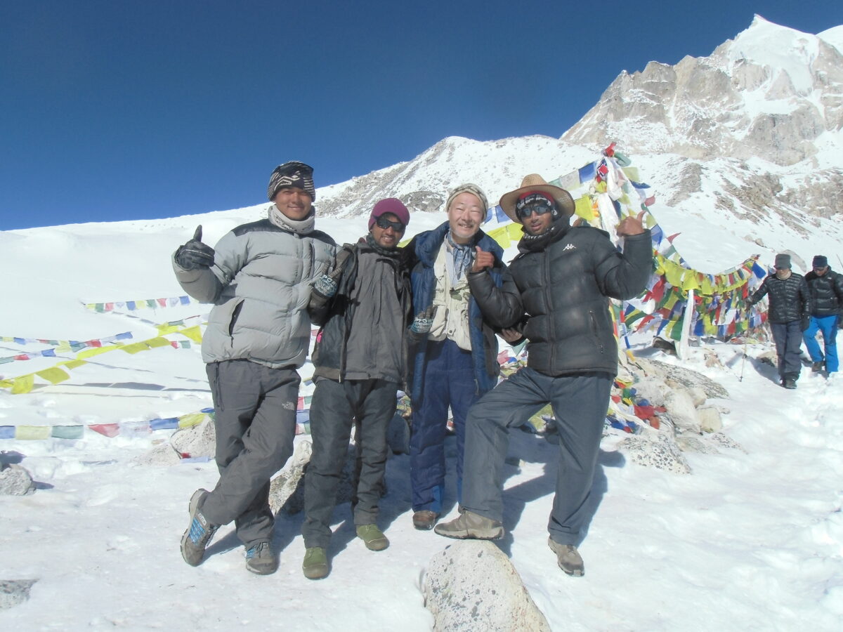
The ascent is long and relentless, taking about 4 to 5 hours. The terrain is a mix of rock, snow, and icy patches. As the sun rises, it hits the surrounding peaks, offering motivation to push through the exhaustion. Finally, you see the prayer flags fluttering in the fierce wind. You have reached Larkya La Pass (5,106m). The sweeping 360-degree view of Himlung Himal, Cheo Himal, Kang Guru, and the massive Annapurna II is one of the most spectacular panoramas in the Himalayas.
After celebrating, you begin the descent. The trail down is incredibly steep, loose, and often slippery with ice and scree. It is tough on the knees and requires immense focus. You eventually drop below the snowline, returning to beautiful alpine meadows, and arrive at the welcoming, cozy lodges of Bimthang, nestled in a deep valley surrounded by glaciers. Overnight in Bimthang.
Day 12: Trek to Dharapani (1,963m / 6,440 ft)
Walking Time: 6-7 hours After the barren, freezing heights of the pass, today feels like a rebirth into a world of color and oxygen. The trail from Bimthang descends rapidly, plunging back into dense, lush forests of rhododendron and pine.
You walk alongside the roaring Dudh Khola (Milk River), passing through the colorful villages of Kharche, Gho, and Tilje, surrounded by terraced fields and wooded hills. The air grows warmer and thicker with every passing hour. Finally, you cross a large suspension bridge and arrive in Dharapani. This bustling village sits on the famous Annapurna Circuit trail, marking the end of your time in the restricted Manaslu area. Dharapani boasts better amenities, hot showers, and a lively atmosphere to celebrate the completion of the trek. Overnight in Dharapani.
Day 13: Drive from Dharapani to Kathmandu
Drive Time: 8-10 hours Today, you say goodbye to the trekking trails. You board a local 4WD Jeep for a rugged, bumpy drive down the steep mountain road, following the Marsyangdi River to the large town of Besisahar. From Besisahar, you transfer to a comfortable vehicle (or tourist bus) and hit the paved Prithvi Highway, following the Trishuli River back to the Kathmandu Valley.
Upon reaching Kathmandu, you are escorted back to your hotel in Thamel. After checking in, take a long, luxurious hot shower. In the evening, Mountain Treks Nepal hosts a farewell dinner at a traditional Nepali restaurant to celebrate your monumental achievement. Overnight in Kathmandu.
Day 14: Final Departure
Your adventure comes to a close. Enjoy a final breakfast and perhaps some last-minute souvenir shopping in Thamel. A representative from Mountain Treks Nepal will escort you to Tribhuvan International Airport approximately three hours before your scheduled flight, ensuring you complete all legal formalities before boarding your flight home, carrying unforgettable memories of the majestic Manaslu Circuit.
Crossing Larkya La Pass (5,106m) and Altitude Safety
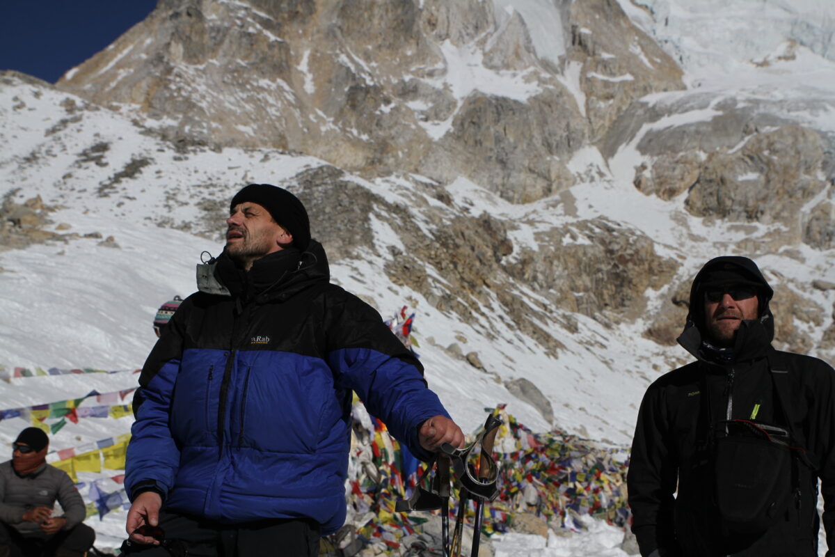
The physical climax of the trek is Larkya La Pass. While it is not a technical climb, it is a formidable high-altitude obstacle.
At 5,100 meters, the effective oxygen level is roughly 50% of what it is at sea level. Acute Mountain Sickness (AMS) is a primary risk. To ensure your safety, our itinerary adheres to the strict medical standard of “climb high, sleep low” and includes mandatory acclimatization in Sama Gaun.
Mountain Treks Nepal Safety Protocols:
-
Oximeter Monitoring: Our licensed guides carry digital pulse oximeters to check your blood oxygen saturation (SpO2) twice daily.
-
Pacing: The ascent to Larkya La must be done at a snail’s pace. Rushing will rapidly exhaust your glycogen stores and induce altitude sickness.
-
Hydration: You must drink 4 to 5 liters of water daily. Dehydration is the fastest path to AMS.
-
Helicopter Evacuation: In the event of a severe emergency, our guides can coordinate helicopter evacuations from Sama Gaun, Samdo, or Bimthang directly to Kathmandu. Comprehensive travel insurance covering high-altitude trekking up to 5,500m is mandatory.
Teahouse Culture: Accommodation, Food, and Wi-Fi on the Trail
The Manaslu Circuit is developing rapidly, but it remains vastly more rustic than the Everest or Annapurna trails.
-
Accommodation: Teahouses are basic, family-run stone or wooden lodges. Rooms are twin-sharing with thin foam mattresses and simple blankets. High-altitude camps (like Dharamsala) are extremely spartan, offering only communal dormitories or semi-permanent stone huts. The only heated space is the communal dining room, warmed by a central wood or yak-dung stove.
-
Food: The staple is Dal Bhat (rice, lentil soup, vegetable curry). It provides massive calories and unlimited refills. You will also find Sherpa stew, Tibetan bread, momos, noodles, and basic pasta. Avoid eating meat above Namrung due to the lack of refrigeration.
-
Wi-Fi and Electricity: Wi-Fi is available in many villages (usually via Everest Link cards) but is notoriously unreliable due to the deep gorge topography. Electricity is generated by small solar panels; charging your devices costs extra ($3-$5) and is entirely dependent on sunny weather. Bring a high-capacity power bank.
Essential Packing List for Manaslu
You must pack for sweltering tropical heat in Machha Khola and arctic winds at Larkya La, all while keeping your duffel bag under the standard 15 kg porter weight limit.
-
Layering System: Avoid cotton entirely. Pack 3 moisture-wicking synthetic t-shirts, heavy Merino wool base layers for sleeping, a fleece mid-layer, and a heavy-duty Gore-Tex waterproof/windproof shell.
-
Insulation: A heavy expedition-grade down jacket (700+ fill power) is mandatory for Dharamsala and the pass crossing.
-
Sleeping Bag: A genuine four-season down sleeping bag rated to -15°C to -20°C is essential. (Mountain Treks Nepal can provide high-quality loaner sleeping bags and down jackets upon request).
-
Footwear: Sturdy, broken-in waterproof trekking boots with good ankle support.
-
Traction / Microspikes: Highly Recommended. The descent from Larkya La to Bimthang is incredibly steep and frequently covered in packed snow and ice. Slip-on microspikes will prevent dangerous falls.
-
Water Purification: Plastic bottles are banned in the conservation area. Bring two 1-liter Nalgene bottles and a reliable purification method (Chlorine Dioxide tablets or a SteriPen).
Mandatory Permits and Guide Regulations (The 2-Person Rule)
Because Manaslu is a restricted area bordering Tibet, the bureaucratic requirements are exceptionally strict. Independent, solo trekking is illegal.
The 2-Person Minimum Rule: The Department of Immigration mandates that a Manaslu Restricted Area Permit (RAP) will only be issued to a minimum of two foreign trekkers applying together, accompanied by a government-licensed guide registered to an authorized trekking agency. (If you are a solo traveler, Mountain Treks Nepal can pair you with another group or arrange a “ghost permit” to satisfy the legal requirement).
Required Permits (Arranged by Mountain Treks Nepal):
-
Manaslu Restricted Area Permit (RAP): Autumn (Sept–Nov) is $100 USD for the first 7 days, plus $15/day thereafter. Spring (Dec–Aug) is $75 USD for the first 7 days, plus $10/day thereafter.
-
Manaslu Conservation Area Project (MCAP) Permit: NPR 3,000 (~$23 USD).
-
Annapurna Conservation Area Project (ACAP) Permit: NPR 3,000 (~$23 USD) required for the exit route through Dharapani.
Best Time to Trek the Manaslu Circuit
-
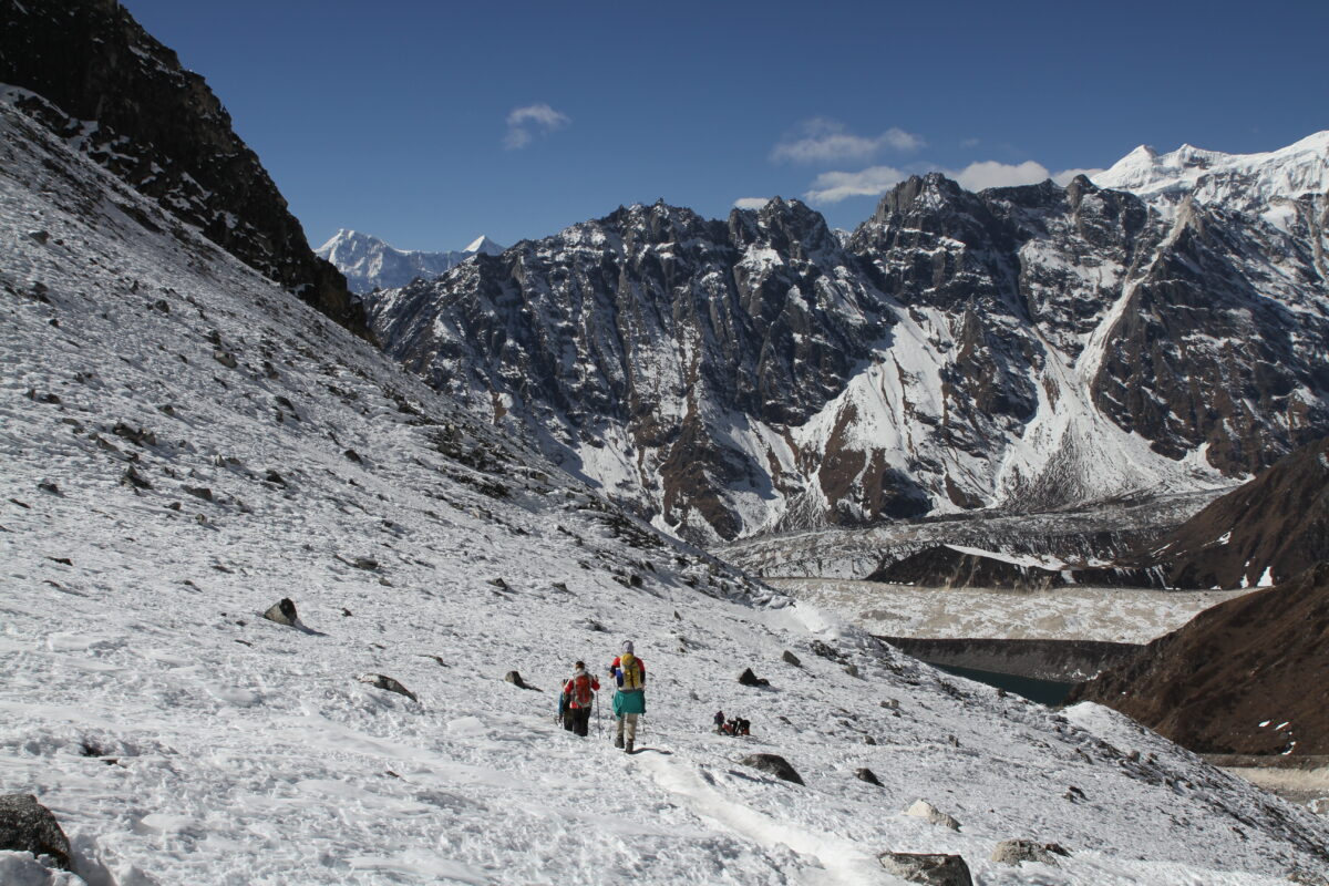
Autumn (Late September to November): The undisputed best season. The monsoon washes the sky clean, offering razor-sharp views of Manaslu. The weather is highly stable, and the Larkya La pass is generally clear of deep, fresh snow until late November.
-
Spring (March to May): A beautiful time to trek, highlighted by blooming rhododendron forests in the lower valleys. The temperatures are warmer, making high camps more comfortable. However, early March can still see heavy winter snow blocking Larkya La, and afternoon haze is common by May.
-
Winter (Dec–Feb) & Monsoon (Jun–Aug): We do not operate this trek in Winter due to extreme cold and heavy snow that completely closes Larkya La pass. The Monsoon season brings severe landslide danger in the steep Budhi Gandaki gorge, making the trail highly treacherous.
Frequently Asked Questions (FAQs)
How difficult is the Manaslu Circuit compared to the Annapurna Circuit?
The Manaslu Circuit is generally considered more rugged and physically demanding than the Annapurna Circuit. The trails in the lower Budhi Gandaki gorge feature more intense “up and down” elevation shifts, and the infrastructure (teahouses) is more basic. Both treks culminate in a massive 5,000m+ pass (Larkya La vs. Thorong La), demanding excellent cardiovascular fitness.
Do I need crampons to cross Larkya La Pass?
You do not need heavy mountaineering crampons or ice axes, but we strongly recommend packing lightweight slip-on microspikes (traction cleats). The steep descent from the summit of Larkya La toward Bimthang is often coated in hard-packed snow or black ice, making microspikes invaluable for safety and protecting your knees.
Can I trek the Manaslu Circuit without a guide?
No. Independent trekking is strictly forbidden by the Nepal government in the Manaslu region. You must be accompanied by a government-licensed Nepali guide affiliated with an authorized trekking agency (like Mountain Treks Nepal) to clear the numerous police checkpoints along the route.
Are there hot showers and charging stations available?
In the lower villages (Machha Khola, Jagat, Namrung), you can often purchase a hot gas-powered or solar shower for $3-$5. Above Sama Gaun, hot showers are generally unavailable, and trekkers rely on wet wipes or a bucket of warm water. Device charging via solar panels is available at most teahouses for a fee, but bringing a high-capacity power bank is highly recommended.
How much weight can a porter carry on the Manaslu Trek?
For ethical and safety reasons, Mountain Treks Nepal enforces a strict porter weight limit. One porter is assigned to every two trekkers, carrying a combined maximum of 20 to 25 kg (about 10 to 12.5 kg per trekker). You will carry only a small 20-30L daypack with your water, camera, extra layers, and valuables.