



Share This:
Manaslu Circuit Trek: Complete Guide (Route, Cost, Itinerary, Permits & Practical Insights for 2026)
Manaslu Circuit Trek: Overview and Key Facts
The Manaslu Circuit trek is one of Nepal’s most comprehensive high-altitude trekking routes, circling Mount Manaslu (8,163 m). This route combines remote landscapes, cultural depth, and a challenging mountain pass, making it a strong alternative to more commercial trekking regions.
The trek typically spans 14–18 days, reaching its highest point at Larkya La Pass (5,106 m). Due to its classification as a restricted trekking region, permits and a licensed guide are mandatory. Operational planning and logistics are commonly handled by experienced agencies such as Mountain Treks Nepal.
Quick summary:
- Duration: 14–18 days
- Maximum altitude: 5,106 m
- Difficulty: Moderate to challenging
- Estimated cost: $1,000–$1,800
- Permit requirement: Restricted area permits + conservation permits
What Is the Manaslu Circuit Trek?
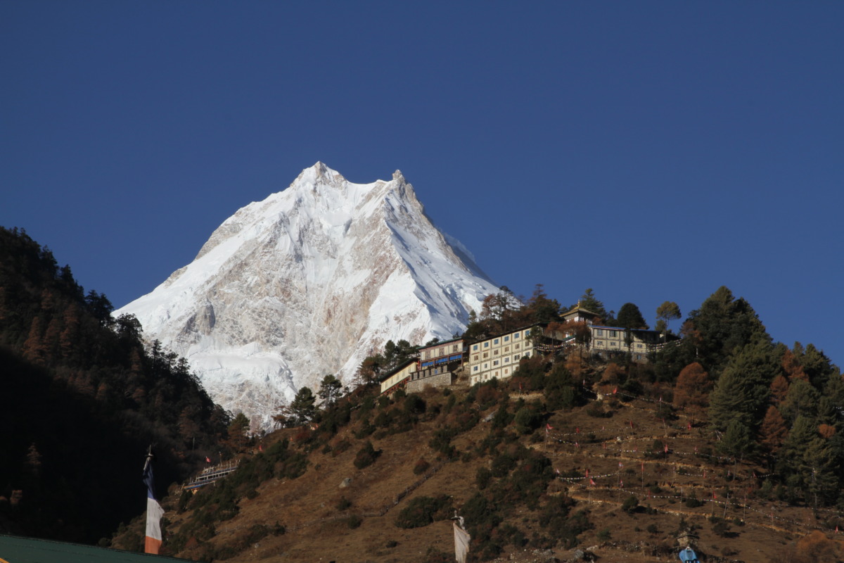
The Manaslu Circuit trek is a remote, high-altitude trekking route in western Nepal that forms a complete circuit around Mount Manaslu (8,163 meters), the eighth-highest peak on Earth. The trail begins in the lowland river valleys of the Budhi Gandaki region and gradually ascends through a wide range of landscapes before reaching the high mountain crossing at Larkya La Pass (5,106 meters). After crossing this pass, the route descends into the Annapurna Conservation Area, where it connects with the broader Annapurna trekking network. This natural loop around the Manaslu massif is what defines it as a “circuit” trek.
One of the defining characteristics of the Manaslu Circuit trek is its low trekking traffic compared to popular routes such as Everest Base Camp and the Annapurna Circuit. This is largely due to its restricted status, which limits access and requires organized trekking arrangements. As a result, the trail experiences significantly less congestion, offering a quieter and more isolated trekking environment. This lower footfall also means fewer commercial developments along the route, preserving the original character of the region.
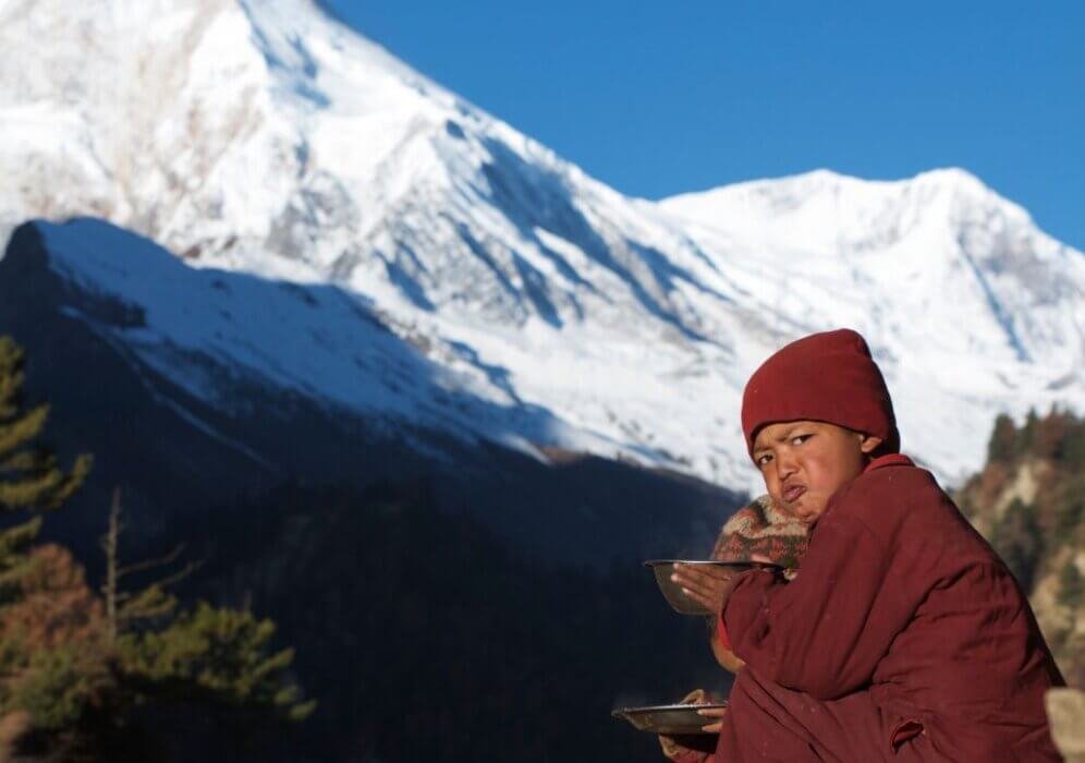
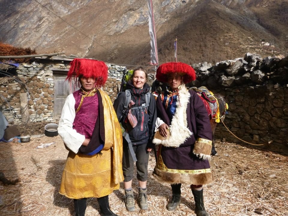
The trek is also recognized for its strong Tibetan cultural influence, particularly in the upper sections near the Nepal–Tibet border. Villages such as Samagaon and Samdo reflect centuries-old traditions rooted in Tibetan Buddhism. Cultural elements such as monasteries (gompas), mani walls, prayer flags, and chortens are common along the trail. Local communities maintain traditional lifestyles based on agriculture, animal husbandry, and trans-Himalayan trade, creating a culturally immersive experience that differs from more commercial trekking regions.
Another important feature of the Manaslu Circuit trek is its gradual ecological transition, which occurs as elevation increases. The route begins in subtropical zones with dense forests, terraced farmland, and warm, humid conditions. As the trail climbs higher, the environment shifts into temperate forests dominated by pine, oak, and rhododendron. Beyond 3,000 meters, the landscape becomes alpine, characterized by sparse vegetation, glacial terrain, and colder temperatures. This continuous change in ecosystems over a relatively short distance contributes to the trek’s environmental diversity and visual variation.
The region’s restricted status plays a central role in shaping the trekking experience. Implemented by the Government of Nepal, these regulations aim to protect both the natural environment and the cultural heritage of the area. Entry requires special permits, and trekking must be conducted with a licensed guide and a minimum group size. While these requirements add logistical complexity, they also help control tourism impact, reduce overcrowding, and maintain the authenticity of the region.
Overall, the Manaslu Circuit trek is defined by its combination of remote geography, cultural preservation, ecological diversity, and regulated access, making it one of the most distinctive and less-commercialized trekking routes in the Himalayas.
Why the Manaslu Circuit Trek Stands Out?
The Manaslu Circuit trek is often evaluated against other major trekking routes in Nepal. The primary differentiators include remoteness, authenticity, and infrastructure level.
Comparison with Popular Treks
| Feature | Manaslu Circuit Trek | Everest Base Camp | Annapurna Circuit |
|---|---|---|---|
| Crowds | Low | Very high | Moderate |
| Infrastructure | Basic | Developed | Developed |
| Cultural authenticity | High | Moderate | Mixed |
| Permit complexity | High | Low | Low |
| Trail commercialization | Minimal | High | Moderate |
Insight:
The Manaslu Circuit trek provides a less commercialized trekking experience, with greater emphasis on cultural immersion and wilderness.
Location and Geographic Context
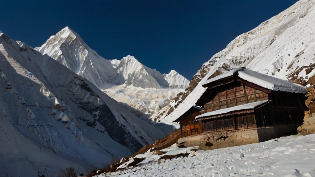
The Manaslu Circuit trek is situated in the remote northern part of Nepal’s Gorkha District, a region known for its rugged terrain and limited infrastructure. The trekking route follows the course of the Budhi Gandaki River, beginning in the lower hills at around 700 meters and gradually ascending toward the high Himalayan zone near Mount Manaslu. The trail continues upward through increasingly narrow valleys before crossing the high-altitude Larkya La Pass and eventually descending into the Annapurna Conservation Area, where it connects with established trekking routes.
This geographic positioning creates a continuous transition from lowland river valleys to high alpine terrain, making the Manaslu Circuit trek one of the most topographically varied routes in Nepal.
Deep River Gorges
The lower and middle sections of the trek are defined by the Budhi Gandaki River gorge, one of the deepest in Nepal. The river cuts through steep hillsides, creating narrow trails carved into cliffs and rocky terrain. Suspension bridges are frequently used to cross the river, often connecting small settlements on opposite sides.
These gorges:
- Limit road access, preserving trail conditions
- Create dramatic vertical landscapes
- Influence microclimates along the route
The confined nature of the valley also means that early stages of the trek involve frequent ascents and descents rather than a continuous uphill climb.
Glacial Valleys
As elevation increases beyond approximately 3,000 meters, the terrain begins to open into glacial valleys formed by historical and present-day glaciation around the Manaslu massif. These valleys are wider, with flatter sections and visible signs of glacial activity such as moraines, rock debris, and meltwater streams.
Characteristics include:
- Broad valley floors near Samagaon and Samdo
- Glacial lakes and seasonal streams
- Reduced vegetation due to altitude
These areas provide clearer views of surrounding peaks and are critical zones for acclimatization.
High Mountain Passes
The most prominent geographic feature of the Manaslu Circuit trek is the crossing of Larkya La Pass (5,106 meters). This pass represents the highest point of the trek and serves as the transition between the Manaslu region and the Annapurna region.
Key aspects of the pass:
- Long ascent over snow and rocky terrain
- Exposure to high-altitude weather conditions
- Panoramic views of Himalayan peaks
The approach to the pass typically involves an overnight stop at Dharamsala (also called Larkya Phedi), which allows for a staged ascent.
Alpine Meadows and High-Altitude Terrain
Above 3,500 meters, the landscape shifts into alpine and subalpine zones, where vegetation becomes sparse and terrain is dominated by grasslands, shrubs, and rocky surfaces. These alpine meadows are often used for seasonal grazing by local communities.
Features include:
- Open landscapes with wide visibility
- Limited tree cover
- Cold, dry climate conditions
These zones mark the transition from inhabited regions to more exposed, high-altitude environments.
Elevation Gain and Acclimatization
A defining strength of the Manaslu Circuit trek is its gradual elevation profile, which supports effective acclimatization when the itinerary is properly structured. Unlike some trekking routes that involve rapid altitude gain, the Manaslu route increases elevation in stages.
Typical progression:
- Slow ascent through lower valleys
- Intermediate acclimatization stops (e.g., Samagaon)
- Final push toward high altitude
This gradual gain:
- Reduces the risk of altitude sickness
- Allows the body to adapt to decreasing oxygen levels
- Improves overall trekking safety
Manaslu Circuit Trek Route Overview
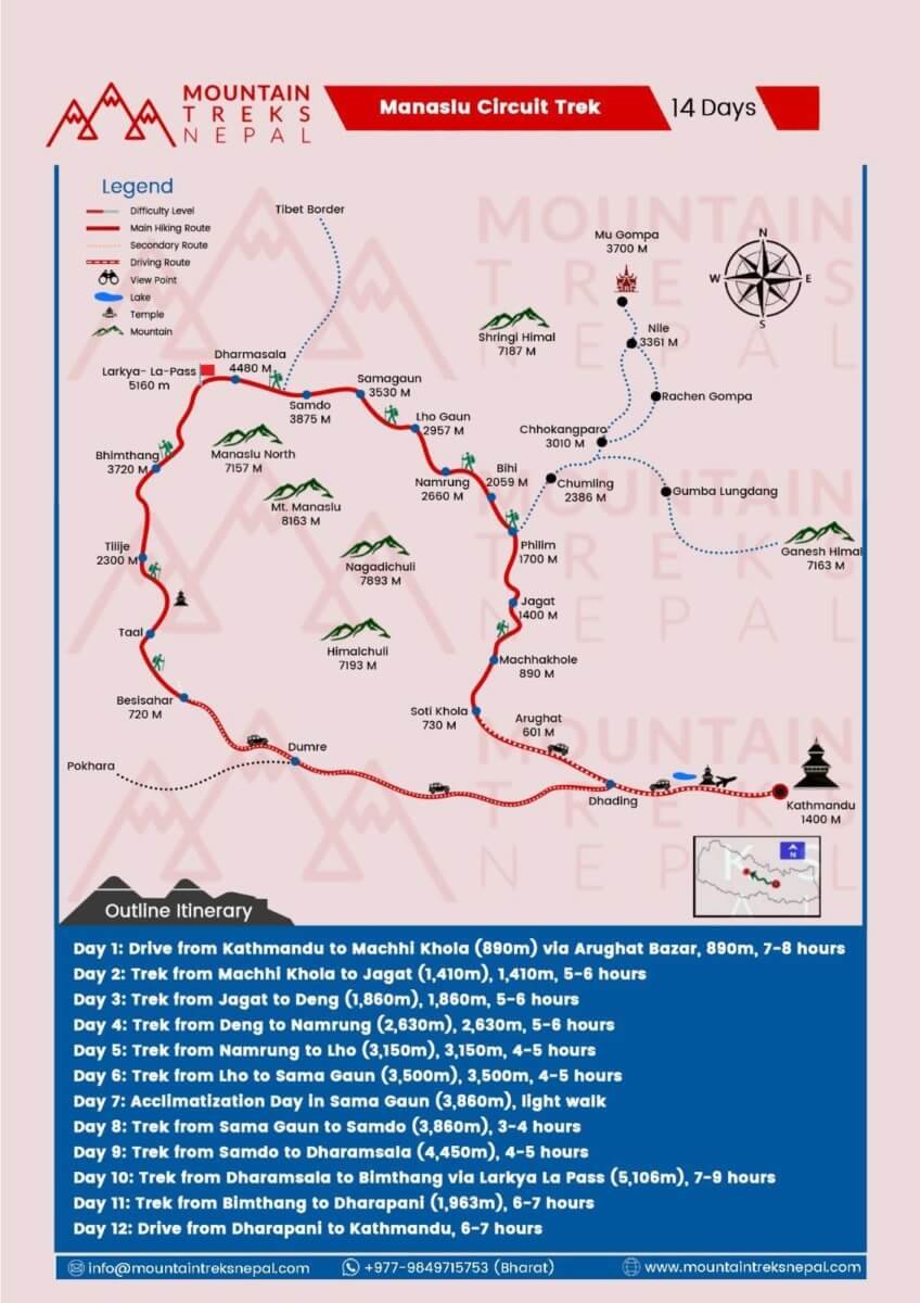
The trekking route progresses through multiple ecological and cultural zones.
Route Structure
- Lower Section (700–1,500 m)
Subtropical forests, terraced fields, river crossings - Middle Section (1,500–3,500 m)
Traditional villages, mixed forests, increasing elevation - Upper Section (3,500–5,106 m)
Alpine terrain, glacial landscapes, high mountain views
Key settlements:
- Jagat: Entry checkpoint
- Namrung: Cultural transition zone
- Samagaon: Acclimatization hub
- Samdo: Final village before the pass
Detailed Manaslu Circuit Trek Itinerary (14–16 Days)
A well-structured itinerary balances altitude gain with recovery periods.
Day-by-Day Itinerary
Day 1: Kathmandu to Soti Khola (700 m)
Road journey with varied terrain and elevation changes.
Day 2: Soti Khola to Machha Khola (930 m)
Trail follows riverbanks with moderate ascents.
Day 3: Machha Khola to Jagat (1,340 m)
Entry into restricted area; permit verification occurs here.
Day 4: Jagat to Deng (1,860 m)
Increasing elevation and transition into narrower valleys.
Day 5: Deng to Namrung (2,630 m)
Vegetation changes, with cooler climate conditions.
Day 6: Namrung to Lho (3,180 m)
First clear views of Manaslu and surrounding peaks.
Day 7: Lho to Samagaon (3,530 m)
Cultural immersion with Tibetan-style settlements.
Day 8: Acclimatization Day (3,530 m)
Short hikes support altitude adaptation.
Day 9: Samagaon to Samdo (3,860 m)
Gradual ascent with reduced vegetation.
Day 10: Samdo to Dharamsala (4,460 m)
Preparation stage before crossing the high pass.
Day 11: Dharamsala to Bimthang via Larkya La Pass (5,106 m)
Longest and most demanding day of the trek.
Day 12: Bimthang to Dharapani (1,960 m)
Descent into greener landscapes and connection with Annapurna trails.
Difficulty Level of the Manaslu Circuit Trek
The Manaslu Circuit trek is categorized as moderate to challenging, primarily due to altitude and remoteness rather than technical complexity.
Key Difficulty Factors
- High altitude exposure above 5,000 m
- Daily walking duration of 6–8 hours
- Limited infrastructure in remote sections
Success Factors
- Proper acclimatization
- Consistent pacing
- Adequate physical conditioning
Observation:
Altitude management plays a more significant role than physical strength alone.
Best Time for Manaslu Circuit Trek

Seasonal timing significantly affects safety and experience.
Seasonal Analysis
Autumn (September–November)
- Stable weather patterns
- Clear mountain visibility
- Peak trekking season
Spring (March–May)
- Moderate temperatures
- Blooming vegetation
- Slight atmospheric haze
Winter (December–February)
- Snow accumulation at high passes
- Increased risk of route closure
Monsoon (June–August)
- Heavy rainfall
- Landslide risk
- Limited visibility
Conclusion:
Autumn provides the most predictable conditions for the Manaslu Circuit trek.
Permits Required for Manaslu Circuit Trek
The restricted status of the Manaslu region requires multiple permits.
Permit Breakdown
| Permit | Purpose | Cost (USD) |
|---|---|---|
| Restricted Area Permit | Regulated access | $100–$150 |
| MCAP | Conservation | $30 |
| ACAP | Annapurna region access | $30 |
Regulatory Requirements
- Minimum group size: 2 trekkers
- Licensed guide: mandatory
- Permit processing: through registered agencies
Cost of Manaslu Circuit Trek
The total cost varies depending on service level and group size.
Cost Breakdown
| Category | Estimated Cost |
|---|---|
| Permits | $160–$210 |
| Guide | $25–$35 per day |
| Porter | $20–$25 per day |
| Accommodation | $5–$10 per night |
| Food | $25–$40 per day |
Total Estimated Cost
👉 $1,000 – $1,800 per person
Additional Expenses
- Charging electronic devices
- Hot showers
- Internet access
Economic insight:
Costs increase with altitude due to transportation challenges and limited supply chains.
Accommodation and Food
Accommodation
Tea houses provide:
- Basic twin-sharing rooms
- Shared sanitation facilities
- Communal dining spaces
Food
Common menu items:
- Dal Bhat (rice and lentils)
- Noodles and soups
- Tibetan bread
- Tea and coffee
Energy intake is critical due to sustained physical activity.
Altitude Sickness: Risk and Management
Altitude-related illness remains a primary concern.
Common Symptoms
- Headache
- Fatigue
- Nausea
Preventive Measures
- Gradual ascent
- Scheduled acclimatization
- Adequate hydration
Response Strategy
- Immediate descent in case of severe symptoms
- Continuous monitoring by guide
Packing List for Manaslu Circuit Trek
Essential Equipment
- Insulated trekking boots
- Down jacket
- Cold-rated sleeping bag
Accessories
- Trekking poles
- Headlamp
- Portable power supply
Health Supplies
- First aid kit
- Water purification system
Manaslu Circuit Trek vs Annapurna Circuit
| Feature | Manaslu Circuit Trek | Annapurna Circuit |
|---|---|---|
| Trail development | Limited | Advanced |
| Crowd density | Low | Moderate |
| Cultural authenticity | High | Moderate |
The Manaslu Circuit trek provides a more isolated and culturally preserved experience.
Role of Mountain Treks Nepal in Trek Planning
Mountain Treks Nepal offers structured trekking services in restricted regions.
Core Services
- Permit processing
- Licensed guide assignment
- Itinerary customization
- Emergency coordination
Operational Advantage
- Knowledge of terrain and weather patterns
- Experience in altitude management
- Local network support
Frequently Asked Questions
How long does the Manaslu Circuit trek take?
The trek typically requires 14–18 days depending on itinerary and acclimatization.
Is the Manaslu Circuit trek difficult?
The trek is considered moderate to challenging due to altitude and remoteness.
Is a guide required?
Yes, a licensed guide is mandatory due to restricted area regulations.
What is the highest point of the trek?
Larkya La Pass at 5,106 meters.
What permits are required?
Restricted Area Permit, MCAP, and ACAP are required.
Final Analysis: Value of the Manaslu Circuit Trek
The Manaslu Circuit trek offers a balanced combination of:
- Remote Himalayan landscapes
- Cultural immersion
- Physical challenge
Compared to other trekking routes in Nepal, it provides a less commercialized and more authentic experience, making it suitable for trekkers seeking depth over convenience.