



Share This:
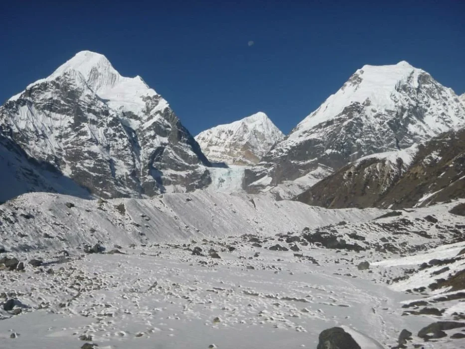
Complete Guide to the Makalu Base Camp Trek: Journey into Nepal’s Wildest Valley
Mount Makalu, towering at an awe-inspiring 8,463 meters (27,766 feet), is the fifth-highest mountain on Earth. Known for its perfect, isolated four-sided pyramid shape, it is a formidable peak that commands respect from mountaineers worldwide. Nestled in the remote eastern Himalayas of Nepal, just 19 kilometers southeast of Mount Everest, the Makalu Base Camp Trek is a journey into one of the most pristine, rugged, and biologically diverse wildernesses on the planet.
Unlike the heavily commercialized trails of the Everest and Annapurna regions, the Makalu Base Camp (MBC) Trek remains a hidden gem, a well-kept secret among alpine purists and veteran trekkers. Here, there are no crowded trails, no luxury bakeries, and no paved roads. Trekking to Makalu Base Camp is an immersion into raw Himalayan survival and untouched natural splendor. The trail takes you from the steamy, terraced lowlands of the Arun Valley, over a series of grueling high-altitude passes, and deep into the sacred, glacial Barun Valley, finally culminating at Base Camp (4,870 meters), where you are rewarded with unparalleled views of Makalu’s colossal south face and the rarely seen Kangshung (eastern) face of Mount Everest.
This exhaustive, encyclopedic guide is crafted by the remote-expedition experts at Mountain Treks Nepal. Whether you are seeking a true off-the-beaten-path adventure or preparing to test your physical limits against one of Nepal’s most demanding routes, this guide covers absolutely every microscopic aspect of the MBC trek. We break down the geology, the local Rai and Sherpa cultures, the rigorous 18-day itinerary, the 2026 permit regulations, the reality of the rustic teahouses, and the exact gear you need to survive the unforgiving high-altitude environment.
The Geography and Ecology of the Makalu Barun Region
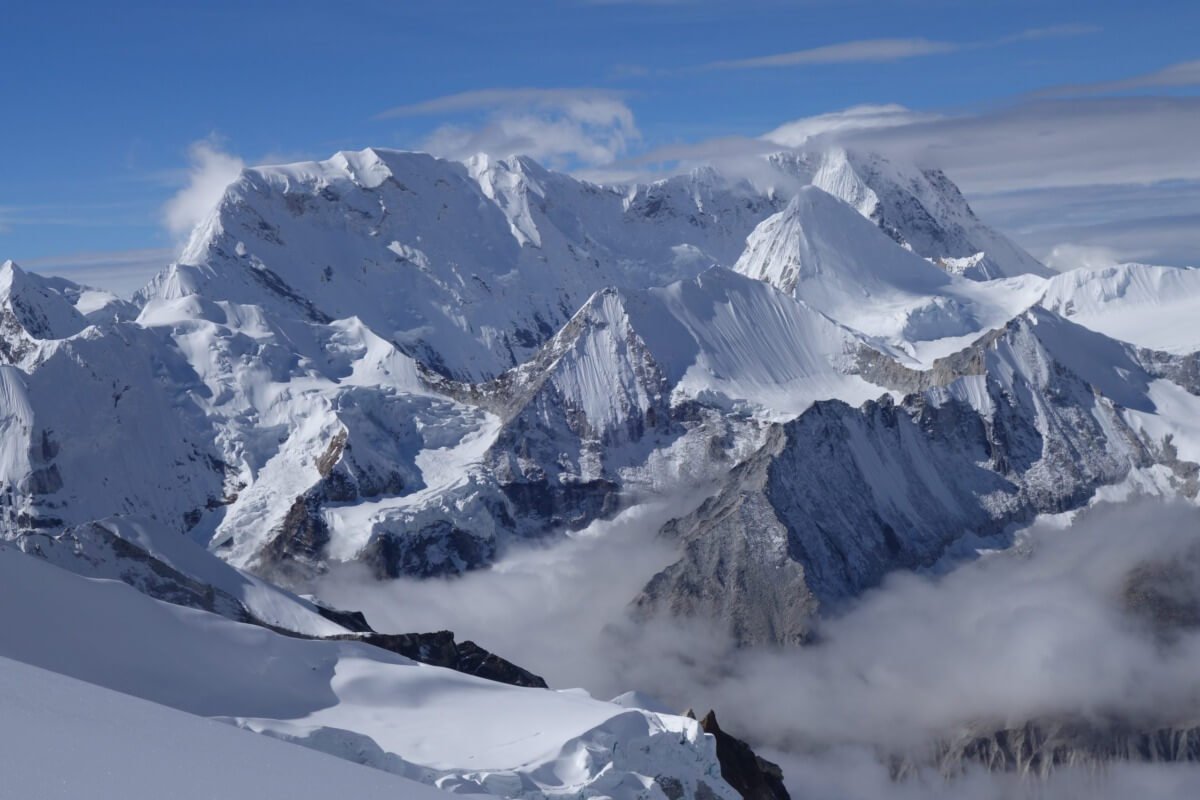
To truly appreciate the Makalu Base Camp Trek, one must understand the sheer scale and ecological significance of the landscape. The trail lies entirely within the Makalu Barun National Park and Conservation Area, established in 1992, covering 1,500 square kilometers. It is the only protected area in the world with an elevation gain of more than 8,000 meters within 30 kilometers.
The Arun and Barun River Valleys
The geography of the MBC trek is dictated by two mighty river systems. The trek begins in the deep, sub-tropical Arun Valley, the deepest valley in the world. The Arun River predates the Himalayas, having carved its way through the mountains as they were pushed up by tectonic forces.
As you cross the Shipton La pass, you leave the Arun watershed and plunge into the Barun Valley. This glacial valley is a sacred, hidden sanctuary. Unlike other Himalayan valleys that have been modified by human habitation and agriculture, the Barun Valley is entirely uninhabited by permanent settlements. It is a true, pristine wilderness of towering granite cliffs, hanging glaciers, and roaring waterfalls.
The Microclimates: From Jungle to Glacial Moraine
Because the trek begins at a sweltering 500 meters (Tumlingtar) and peaks at over 5,000 meters, it encompasses nearly every climatic zone found in Nepal.
-
Sub-Tropical (Below 2,000m): Around Tumlingtar, Num, and Seduwa, the environment is intensely hot and humid. You will walk through dense jungles of bamboo, banana trees, and cardamom plantations, surrounded by vibrant green terraced fields.
-
Temperate and Sub-Alpine (2,000m – 3,500m): As you climb past Tashigaon and Khongma Danda, the jungle gives way to fragrant broadleaf forests of oak, maple, and rhododendron. In the spring (March to May), these forests erupt into a vibrant canopy of red, pink, and white blossoms.
-
Alpine Tundra (3,500m – 4,500m): Once you cross the passes and descend into Yangle Kharka, the tall trees vanish. The landscape transforms into a high-altitude grazing pasture of juniper, alpine scrub, and moss.
-
Nival Zone (Above 4,500m): Approaching Makalu Base Camp, you enter a stark, magnificent landscape of rock, ice, and glacial moraines. The vegetation disappears entirely, replaced by the sheer, terrifying scale of the Himalayas.
Flora and Fauna
The Makalu Barun National Park is recognized globally for its biodiversity. The park is home to over 3,000 species of flowering plants, including 47 types of orchids and 25 species of rhododendrons.
Wildlife is abundant but elusive. In the lower temperate forests, you may spot Langur monkeys, barking deer, and the vibrant Himalayan Monal (Danphe). The dense bamboo groves are prime habitat for the endangered Red Panda. As you push into the alpine zones near Langmale Kharka and Base Camp, you are in the territory of Himalayan Tahr, Blue Sheep, Himalayan Black Bears, and the apex predator—the Snow Leopard.
History and Cultural Heritage
The Makalu region is not just an ecological wonderland; it is a region rich in cultural diversity. As you ascend from the lowlands to the high Himalayas, you journey through the heartlands of different ethnic groups.
The Rai and Limbu People of the Lowlands
The lower sections of the trek, particularly around Tumlingtar, Num, and Seduwa, are predominantly inhabited by the Rai and Limbu communities. These indigenous groups have lived in the eastern hills for centuries. They are traditionally agriculturalists, farming the steep terraced hillsides. Their culture is rich with animist traditions, deeply connected to the land and the ancestors. As you walk through their villages, you will witness a traditional way of life that has remained largely untouched by modern tourism.
The Sherpas and Shingsawas of the Highlands
As you climb higher, the cultural landscape shifts. The village of Tashigaon (approx. 2,100m) is the last permanent settlement on the route. It is a traditional Sherpa village. The Sherpas of the Makalu region, along with the Shingsawa (Bhotia) people, migrated from Tibet centuries ago.
Their culture is deeply rooted in Tibetan Buddhism. You will pass chortens, mani walls, and prayer flags fluttering in the wind. The mountains themselves hold profound spiritual significance. The Barun Valley is considered a “Beyul,” a sacred hidden valley in Tibetan Buddhist tradition, believed to be a sanctuary blessed by Guru Rinpoche where only the pure of heart can find refuge in times of crisis.
Why Choose the Makalu Base Camp Trek?
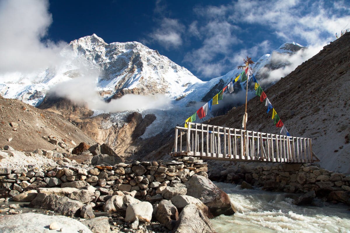
If you are torn between Nepal’s various trekking routes, here is why the Makalu Base Camp Trek is the ultimate choice for the true adventurer.
-
Absolute Wilderness and Solitude: While Everest and Annapurna see tens of thousands of trekkers, Makalu sees only a fraction of that. You will not have to fight for a bed in a teahouse or walk in a constant convoy of other groups. On many days, it is just you, your team, and the mountains.
-
The Kangshung Face of Everest: Makalu Base Camp offers one of the rarest and most spectacular views in the Himalayas—a clear view of the Kangshung (eastern) face of Mount Everest, along with Mount Lhotse and Chamlang. This is a perspective of Everest that very few people on Earth ever get to see.
-
Ecological and Topographical Diversity: No other trek in Nepal offers such a dramatic and rapid transition from sweltering sub-tropical jungles to freezing glacial moraines.
-
A True Physical Challenge: The MBC trek is not for the faint of heart. Crossing the Shipton La pass and navigating the steep, rugged trails requires immense stamina and mental grit. It is a badge of honor for veteran trekkers.
How Difficult is the Makalu Base Camp Trek?

The Makalu Base Camp Trek is universally graded as Strenuous to Extreme. It does not require technical mountaineering skills (you do not need ropes or ice axes), but it is a relentless, punishing test of physical and mental endurance.
The Terrain and the “Nepali Flat”
The trail is incredibly rugged. The lower sections involve brutal, humid ascents and knee-crushing descents. The hike from Num to Seduwa, for example, involves dropping 800 vertical meters to the Arun River and immediately climbing 800 meters back up the other side. The trails are often narrow, rocky, and slippery, requiring immense concentration and sure-footedness.
The Shipton La Pass
The crux of the trek is crossing the Khongma ridge into the Barun Valley. This involves navigating a series of high-altitude passes in a single day: Ghungru La (4,055m), Shipton La (4,125m/4,216m), and Keke La (4,170m). Crossing these passes requires extreme cardiovascular exertion in thin air. Furthermore, if you trek in early spring or late autumn, these passes can be buried in snow and ice, making the crossing treacherous without microspikes.
The Isolation
The physical difficulty is compounded by the lack of infrastructure. Once you leave Tashigaon, there are no permanent villages. The teahouses in the Barun Valley are incredibly basic, often just stone huts. There is no Wi-Fi, no cellular service, and no luxury bakeries to lift your spirits. You must have the mental resilience to endure cold nights, basic food, and total isolation.
The Definitive 18-Day Makalu Base Camp Itinerary (Day-by-Day)
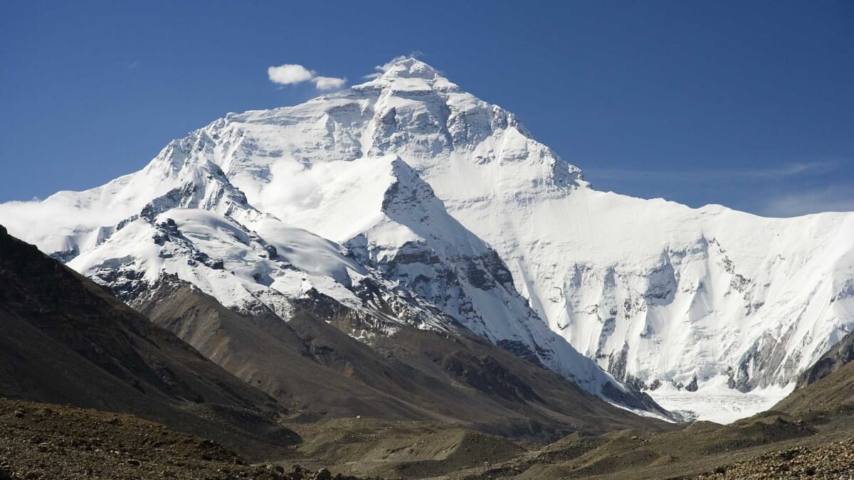
This is the exact, field-tested operational itinerary utilized by Mountain Treks Nepal. It is specifically engineered to balance strenuous physical exertion with the crucial physiological need for high-altitude acclimatization, ensuring you conquer the Shipton La and Base Camp safely.
Day 1: Arrival in Kathmandu (1,350m)
Your Himalayan expedition begins the moment your flight touches down at Tribhuvan International Airport in Kathmandu. As you step out of the terminal into the vibrant, chaotic energy of Nepal’s capital, a representative from Mountain Treks Nepal will be waiting with a traditional marigold garland to welcome you.
You will be transferred via a private, air-conditioned vehicle to your boutique hotel in Thamel. After checking in, take a hot shower and shake off the jet lag. In the evening, you will meet your lead trekking guide and the expedition manager. This briefing is critical. We will review the 18-day itinerary, verify your travel insurance, and finalize your Makalu Barun National Park permits. Your guide will also conduct a rigorous gear check. Overnight in Kathmandu.
Day 2: Fly to Tumlingtar and Drive to Num (1,560m)
Flight Time: 45 minutes | Drive Time: 4 to 5 hours
After an early breakfast, you transfer to the domestic airport for a spectacular flight to Tumlingtar (518m). The 45-minute flight offers breathtaking aerial views of the eastern Himalayas, including Makalu, Everest, and Kanchenjunga.
Upon landing in the sweltering heat of Tumlingtar, you board a rugged 4WD Jeep. The drive to Num is a bumpy, winding, and thrilling off-road journey. You travel along the ridge line, passing through rural villages and lush, green hillsides. Finally, you arrive in Num (1,560m), a spectacularly placed village situated on a ridge above the Arun River. The air here is hot and humid. Overnight in a local lodge in Num.
Day 3: Trek from Num to Seduwa (1,500m)
Walking Time: 5 to 6 hours
Elevation Profile: -800m Descent / +800m Ascent
Your first day of trekking is a brutal introduction to the rugged terrain of eastern Nepal. Leaving Num, the trail plunges steeply down through dense, steamy jungle and terraced fields toward the Arun River. The descent is punishing on the knees, and the humidity is intense.
After crossing the roaring Arun River on a long suspension bridge (at approx. 700m), you immediately face a grueling, steep, and relentless climb up the opposite side of the valley to reach the village of Seduwa (1,500m). Seduwa is a beautiful settlement surrounded by terraced farms of corn and barley. Here, you officially enter the Makalu Barun National Park, and your guide will register your permits at the checkpoint. Overnight in Seduwa.
Day 4: Trek from Seduwa to Tashigaon (2,100m)
Walking Time: 4 to 5 hours
Elevation Gain: +600m
Today’s trek is much more moderate and highly scenic. Leaving Seduwa, the trail climbs gradually through idyllic, terraced farmland, meadows, and small Rai and Sherpa hamlets. The path crosses several small streams and winds through lush forests.
You pass through the villages of Hindrungma and Rupisa before arriving at Tashigaon (2,100m). Tashigaon is a traditional Sherpa village and holds significant importance: it is the very last permanent settlement on the route. Beyond here, there are only seasonal herding pastures and basic trekking huts. Spend the afternoon exploring the village, buying any last-minute snacks, and preparing for the wilderness ahead. Overnight in Tashigaon.
Day 5: Trek from Tashigaon to Khongma Danda (3,500m)
Walking Time: 6 to 7 hours
Elevation Gain: +1,400m
Today is one of the toughest days of the entire expedition. You must gain massive elevation as you climb the Khongma ridge. The trail leaves Tashigaon and ascends steeply via endless switchbacks through dense, beautiful, and silent forests of rhododendron and oak.
As you climb higher, the humidity vanishes, the air turns crisp, and the trees begin to thin. You will pass the natural water source at Dhara, an excellent place to stop for lunch. The final push brings you above the tree line to Khongma Danda (3,500m). From this high ridge, you are rewarded with spectacular, sweeping views of the surrounding valleys and distant peaks. The temperature drops sharply here. Overnight in a basic teahouse at Khongma.
Day 6: Mandatory Acclimatization Day at Khongma Danda (3,500m)
At 3,500 meters, taking a rest day is a strict medical necessity to prevent Acute Mountain Sickness (AMS) before attempting the massive passes tomorrow.
Following the “climb high, sleep low” principle, your guide will lead a morning acclimatization hike up the ridge toward the passes. This short hike triggers red blood cell production, helping your body adapt to the thin air. Spend the afternoon resting, drinking massive amounts of tea and water to rehydrate, and mentally preparing for the Shipton La traverse. Overnight in Khongma.
Day 7: Trek to Dobato (3,870m) via Shipton La Pass (4,216m)
Walking Time: 6 to 8 hours
Elevation Profile: Extreme Undulation
Today is the physical climax of the approach. You must cross the rugged, high-altitude spine separating the Arun and Barun valleys.
You start early, climbing steeply up the ridge. You will cross a total of three or four passes today. The first is Ghungru La (4,055m). The trail then drops slightly before climbing to the main obstacle: Shipton La (4,125m / 4,216m). From the crest of Shipton La, draped in prayer flags, the panoramic views of Chamlang, Peak 6, and Peak 7 are absolutely breathtaking.
You descend slightly past the sacred, sacred glacial lake of Kalo Pokhari before immediately climbing the final pass, Keke La (4,170m). After clearing the final pass, you endure a steep, rocky descent through alpine scrub into the beautiful, remote valley of Dobato (3,870m). You will be exhausted, but you have successfully entered the sacred Barun Valley. Overnight in Dobato.
Day 8: Trek from Dobato to Yangle Kharka (3,600m)
Walking Time: 5 to 6 hours
Elevation Loss: -270m
Leaving Dobato, the trail descends steeply through dense, damp forests of rhododendron and pine. The environment feels incredibly wild and primeval.
You finally reach the valley floor and arrive at the banks of the Barun River. The trail now follows the river upstream. The valley widens, revealing towering granite cliffs and cascading waterfalls that rival the beauty of Yosemite. You walk through lush juniper forests and seasonal yak pastures. Finally, you arrive at Yangle Kharka (3,600m), a wide, flat, incredibly scenic pasture nestled deep in the valley. Overnight in a basic teahouse at Yangle Kharka.
Day 9: Trek from Yangle Kharka to Langmale Kharka (4,410m)
Walking Time: 4 to 5 hours
Elevation Gain: +810m
The trek today is relatively short but involves significant altitude gain. You follow the Barun River upstream, walking through an increasingly barren, U-shaped glacial valley. The trees disappear entirely, replaced by high alpine scrub, rocks, and moraines.
You pass the pasture of Mumbuk (or Nehe Kharka) and walk alongside ancient prayer walls and mani stones. The air becomes noticeably thinner, and your pace will slow to a crawl. You are surrounded by towering, glaciated peaks. You arrive at Langmale Kharka (4,410m), a desolate but stunningly beautiful high camp. The temperatures here drop well below freezing at night. Overnight in Langmale.
Day 10: Trek from Langmale Kharka to Makalu Base Camp (4,870m)
Walking Time: 5 to 6 hours
Elevation Gain: +460m
The Summit Day. You begin the hike climbing through a harsh, rocky, and icy landscape. The trail crosses moraine deposits, rocky land, and potential snow and ice patches. The Barun Glacier flows parallel to the trail.
As you climb higher, the sheer scale of the Himalayas engulfs you. Suddenly, the valley opens up, and you have arrived at Makalu Base Camp (4,870m).
The view from MBC is simply staggering. Mount Makalu (8,463m) dominates the sky, its sheer, terrifying south face looming directly above the camp. To the northwest, you are rewarded with a crystal-clear view of the Kangshung face of Mount Everest and Mount Lhotse. You are standing in one of the most remote and spectacular amphitheaters on Earth. Overnight in a basic stone teahouse at Makalu Base Camp.
Day 11: Exploration Day at Makalu Base Camp (up to 5,300m)
Walking Time: 3 to 6 hours (Exploration)
Waking up at Base Camp is a surreal experience. After a hot breakfast in the freezing morning air, today is dedicated to exploring this magnificent glacial wonderland.
Your guide will lead you on a hike higher up the rocky ridges toward Makalu Advanced Base Camp or Swiss Base Camp (up to 5,300m). The views from these higher vantage points are even more dramatic, offering a closer look at the Barun Glacier, turquoise glacial lakes, and the jagged peaks of the Everest massif. After an exhausting but visually overwhelming day, return to Base Camp to rest and soak in the raw grandeur of the Himalayas. Overnight at Makalu Base Camp.
Day 12: Trek from Makalu Base Camp to Yangle Kharka (3,600m)
Walking Time: 6 to 7 hours
Elevation Loss: -1,270m
It is time to leave the high alpine desert behind. You begin the long journey back to civilization by retracing your steps entirely.
Because you are descending and the air is getting thicker and richer with oxygen, you will feel a massive surge of energy. You walk past Langmale Kharka, descending through the rocky moraines and back into the lush, green pastures. The return to the juniper and rhododendron forests feels like a return to paradise. You arrive back at the wide, peaceful valley of Yangle Kharka for a restful night. Overnight in Yangle Kharka.
Day 13: Trek from Yangle Kharka to Dobato (3,870m)
Walking Time: 5 to 6 hours
Elevation Gain: +270m
Leaving Yangle Kharka, you follow the Barun River downstream before beginning the steep, demanding climb back out of the Barun Valley.
You ascend through the dense, misty rhododendron and pine forests. The climb is taxing on the legs, but the lower altitude makes the breathing easier. You arrive back at the small settlement of Dobato, preparing yourself for the massive pass crossing tomorrow. Overnight in Dobato.
Day 14: Trek from Dobato to Khongma Danda (3,500m) via Shipton La
Walking Time: 6 to 7 hours
Today you must re-cross the formidable Khongma ridge. You start early, climbing back up to Keke La (4,170m), descending to Kalo Pokhari, and making the grueling push up to the prayer flags of Shipton La (4,216m).
As you cross the passes, take a moment to look back at the peaks of Chamlang and the Barun Valley for the final time. You descend over Ghungru La and drop all the way back down to the ridge at Khongma Danda. You have successfully conquered the passes in both directions. Overnight in Khongma.
Day 15: Trek from Khongma Danda to Seduwa (1,500m)
Walking Time: 6 to 7 hours
Elevation Loss: -2,000m
Today is characterized by a massive, relentless descent. Leaving the high ridge of Khongma, the trail drops sharply back into the dense, humid temperate forests.
This descent is incredibly punishing on the knee joints. You must use trekking poles and proceed with caution. You pass through Tashigaon, officially re-entering civilization and permanent settlements. Continuing down through the terraced farmlands, you finally arrive back at Seduwa. The air is warm, thick, and highly oxygenated. Enjoy the comfort of the lower altitudes. Overnight in Seduwa.
Day 16: Trek from Seduwa to Num (1,560m)
Walking Time: 5 to 6 hours
Your final day of walking is another brutal test of the “Nepali Flat.” You must descend 800 vertical meters down a steep, sweating trail to cross the mighty Arun River, and then immediately climb 800 vertical meters back up the opposite ridge to reach Num.
Arriving in Num marks the official end of your trek. You have conquered one of the hardest trails in Nepal. You check into a lodge, enjoy your first cold beer in over two weeks, and celebrate with your guide and porters. Overnight in Num.
Day 17: Drive from Num to Tumlingtar (518m)
Drive Time: 4 to 5 hours
In the morning, you board a 4WD jeep for the rugged, bumpy drive back along the ridge lines to Tumlingtar. As you drive, you can look back toward the north and see the distant, snow-capped peaks of the Makalu range, marveling at how far you walked.
Upon arriving in Tumlingtar, you check into a hotel. The tropical heat of the lowlands is a stark contrast to the glacial ice of Base Camp. Enjoy a long, luxurious hot shower and a massive dinner. Overnight in Tumlingtar.
Day 18: Flight to Kathmandu and Final Departure
After breakfast, you transfer to the Tumlingtar airport and board your 45-minute domestic flight back to Kathmandu.
Upon landing in the capital, you are escorted back to your hotel in Thamel. The afternoon is free for well-deserved massages, souvenir shopping, or simply relaxing in a bakery. In the evening, Mountain Treks Nepal will host a grand farewell dinner at a traditional Nepali restaurant to celebrate the monumental success of your expedition.
Depending on your international flight schedule, a representative will transfer you to Tribhuvan International Airport three hours before your departure. You bid farewell to Nepal, carrying home an indelible sense of achievement, a camera full of extraordinary memories, and a new perspective on the world.
Altitude Sickness and Medical Safety at 4,870m
While Makalu Base Camp is slightly lower than Everest Base Camp, sleeping at 4,870 meters presents a critical, life-threatening risk of Acute Mountain Sickness (AMS).
At Makalu Base Camp, the effective oxygen level in the air is roughly 55% of what it is at sea level. Your body must work incredibly hard to oxygenate your blood.
Recognizing the Symptoms
AMS occurs when you ascend faster than your body can adapt to the decreasing oxygen.
-
Mild AMS: Headache, nausea, dizziness, extreme fatigue, shortness of breath, and loss of appetite.
-
Severe AMS (HAPE/HACE): Severe confusion, inability to walk in a straight line (ataxia), a rattling cough with pink frothy sputum, and extreme lethargy. High Altitude Pulmonary Edema and Cerebral Edema are fatal medical emergencies requiring immediate descent.
Mountain Treks Nepal Safety Protocols
We do not take chances with altitude on this remote expedition.
-
Meticulous Pacing: Our itinerary includes a mandatory rest and acclimatization day at Khongma Danda (3,500m). This is non-negotiable before pushing over the 4,000m Shipton La pass.
-
Oximeter Monitoring: Our government-licensed, wilderness first-aid-certified guides carry digital pulse oximeters. Every morning and evening, we measure your blood oxygen saturation and resting heart rate to detect altitude stress before severe symptoms manifest.
-
Hydration: Dehydration is a massive catalyst for AMS in the dry mountain air. You must drink 4 to 5 liters of purified water every day on the trail.
-
Helicopter Evacuation: The Makalu region is incredibly remote. There are no hospitals or HRA clinics on the trail. In the event of a severe medical emergency (such as HAPE), Mountain Treks Nepal is equipped with satellite communication to coordinate a rapid helicopter evacuation directly from Makalu Base Camp or Yangle Kharka to a hospital in Kathmandu. Comprehensive travel insurance covering high-altitude evacuation up to 5,500 meters is absolutely mandatory.
Teahouse Culture: Food, Lodging, and Off-the-Grid Reality
If you are expecting the bakeries, Irish pubs, and en-suite bathrooms of the Everest Circuit, the Makalu trail will be a severe shock. The infrastructure here is minimal, rustic, and highly utilitarian.
Accommodation (The Teahouses)
-
Lower Elevations (Num, Seduwa, Tashigaon): Teahouses here are relatively comfortable. You will find basic wooden beds, foam mattresses, and shared outdoor squat toilets.
-
Higher Elevations (Khongma to Makalu Base Camp): The teahouses in the Barun Valley and high camps are incredibly basic, often constructed of rough stone walls with tin or plywood roofs. There is zero insulation. The rooms are freezing at night, with temperatures dropping well below freezing. You must bring a genuine -15°C to -20°C four-season down sleeping bag. The only heated space is the communal dining room, warmed by a central wood or yak-dung burning stove.
Food and Nutrition
Because there are no roads, all food above Tashigaon is carried up by porters or yaks. The menu is strictly limited to non-perishable, high-carbohydrate staples designed to fuel your hiking.
-
Dal Bhat: The undisputed king of the Himalayas. Steamed rice, lentil soup, vegetable curry, and spicy pickles. It provides massive calories and comes with unlimited free refills. You will eat this for lunch and dinner almost every day.
-
Other Options: You will find basic variations of fried noodles, potatoes, Tibetan bread, Tsampa (roasted barley flour), and eggs.
-
The Meat Warning: Never eat meat above Seduwa. There is absolutely no refrigeration on the mountain. Any meat served in a high camp has been sitting at room temperature for days. Adhere to a strict vegetarian diet to avoid severe gastrointestinal illness on the trail.
Electricity and Connectivity
-
Cellular Service & Wi-Fi: There is zero cellular service and no Wi-Fi once you leave Tashigaon. You are completely off the grid. Enjoy the digital detox.
-
Charging: Electricity is provided entirely by small solar panels, which are unreliable in cloudy weather. Charging your phone or camera battery will cost money ($3 to $5) and is only available if the sun was shining. You must bring a high-capacity (20,000mAh+) power bank and store it inside your sleeping bag at night so the freezing temperatures do not drain the lithium-ion batteries.
Essential Packing List for the Makalu Trek
Packing for Makalu requires extreme precision. You must pack for 35°C (95°F) humid jungle heat in Tumlingtar and -15°C (5°F) freezing arctic winds at Makalu Base Camp, all while keeping your duffel bag under the strict 15 kg (33 lbs) porter weight limit.
The Alpine Layering System (Zero Cotton)
-
Base Layers: 3 moisture-wicking synthetic t-shirts for the hot lowlands. 2 pairs of heavy-weight Merino wool thermal tops and bottoms dedicated exclusively for the higher camps and sleeping. No cotton.
-
Mid Layers: 1 lightweight grid fleece for active hiking, and 1 heavier synthetic insulated jacket for evenings.
-
Outer Shell: 1 heavy-duty, waterproof, and windproof jacket (Gore-Tex) and waterproof rain pants. Windchill is your biggest enemy on Shipton La.
-
Heavy Down Jacket: A 700 to 800+ fill-power expedition down parka with an insulated hood is mandatory for Langmale and Base Camp. (Mountain Treks Nepal provides high-quality down jackets as complimentary loaner gear).
Hardware and Sleeping Gear
-
Four-Season Sleeping Bag (-15°C to -20°C): Do not skimp on this. Teahouse bedrooms are freezing, and blankets are scarce. (Mountain Treks Nepal provides high-quality -20°C loaner sleeping bags to all clients).
-
Footwear: Sturdy, waterproof trekking boots with rigid ankle support and deep Vibram soles. They must be fully broken in. Pack 4 pairs of Merino wool trekking socks and lightweight camp shoes (Crocs) for the teahouses.
-
Microspikes (Slip-on Crampons): Highly Recommended. If you trek in early spring or late autumn, the steep descents from Shipton La and Keke La can be covered in packed snow and dangerous black ice. Slip-on traction spikes will prevent catastrophic falls.
-
Trekking Poles (Flick-Lock): Non-negotiable. They protect your knee joints during the grueling descents to the Arun River and provide essential balance on loose glacial scree.
-
Water Purification System: Plastic water bottles are banned. Carry two 1-liter Nalgene bottles. Use chlorine dioxide tablets or a SteriPen to purify all drinking water.
-
First Aid & Meds: A robust blister kit (Compeed), Ibuprofen, broad-spectrum antibiotics for GI issues, and Diamox for altitude.
Best Time to Trek to Makalu Base Camp
The Makalu region’s geography means it is highly susceptible to the monsoon. To experience the trek safely, cross the high passes, and guarantee the best mountain views, you must travel during Nepal’s two distinct trekking windows.
1. Autumn (Late September to November) — The Crystal Clear Skies
Autumn is universally recognized as the absolute best time for the Makalu Base Camp Trek.
-
Weather: By late September, the summer monsoon retreats, washing the dust from the sky and leaving behind pristine, hyper-stable atmospheric conditions.
-
Visibility: October offers the absolute best atmospheric clarity and mountain views of Makalu and the Kangshung face of Everest.
-
Trail Conditions: Trails are dry, and the Shipton La pass is clear of deep snow.
-
Temperatures: Daytime hiking temperatures are comfortable. Nighttime temperatures drop significantly by November, especially at Base Camp (-10°C to -15°C).
2. Spring (Mid-April to May) — The Rhododendron Bloom
Spring is the second premier window, bringing vibrant color and warming temperatures.
-
Flora & Fauna: The temperate forests between Seduwa and Khongma Danda erupt into a breathtaking sea of blooming red, pink, and white rhododendrons and magnolias. Wildlife activity peaks during this window.
-
Temperatures: Days are noticeably warmer, making the high camps more comfortable.
-
Crucial Warning for Spring: Do not go too early. In March and early April, the Shipton La pass can still be buried in deep winter snow or sealed with ice, making crossing incredibly dangerous or impossible. The best spring window is mid-April through May. Also, expect afternoon cloud buildups by late May.
3. Winter (December to February) & Monsoon (June to August)
-
Winter: We strongly discourage trekking Makalu in winter. Extreme freezing winds, heavy snowfall, and the absolute burial of the Shipton La pass make the trek impassable and highly dangerous. Furthermore, teahouses in the Barun Valley close as locals migrate to the lowlands.
-
Monsoon: Do not trek in the summer. The eastern Himalayas take the full force of Nepal’s monsoon. The Arun Valley channels rainfall aggressively, resulting in severe landslide risks, muddy and treacherous trails, and massive leech infestations below 2,000m.
Permits, Costs, and Logistics (2026-2027 Updates)
Unlike Kanchenjunga or Upper Mustang, the standard Makalu Base Camp Trek does not require a highly expensive Restricted Area Permit (RAP), provided you stay on the main route. However, specific national park permits are strictly enforced.
Required Permits (Arranged by Mountain Treks Nepal)
-
Makalu Barun National Park Entry Permit: The official fee is NPR 3,000 (approx. $23 USD) for foreign nationals. This fee directly funds environmental protection, anti-poaching patrols (vital for snow leopards and red pandas), and trail maintenance within the park.
-
TIMS (Trekkers’ Information Management System) Card: The fee is NPR 2,000 (approx. $15 USD) for foreign nationals. This ensures your data is registered with the government for safety, tracking, and emergency rescue purposes.
-
Local Municipality Fees: Depending on local regulations in the Sankhuwasabha district, a small local tax (approx. $15-$20) may be collected at the trailhead.
The Mandatory Guide Regulation
As mandated by the Nepal Tourism Board, all foreign trekkers must hire a government-licensed guide affiliated with an authorized trekking agency to trek in Nepal’s national parks. Independent, solo trekking is legally banned. You will be turned away at the Seduwa checkpoint if you arrive without a licensed Nepali guide. This rule ensures trekker safety in this highly remote, high-altitude wilderness, while also providing vital local employment.
Physical Training: How to Prepare for Makalu
You cannot walk off the couch and conquer the Makalu Base Camp trek. You will be walking for 5 to 7 hours a day for 15 days straight, covering roughly 140 kilometers over incredibly steep, rugged terrain, and navigating passes above 4,000 meters. You must begin training at least 12 weeks before departure.
-
The Stairmaster and Rucking: The defining physical challenge of Makalu is the steep ascents and descents (the brutal drop to the Arun River and the climb to Khongma). The most specific and effective training you can do is climbing stairs. Load a backpack with 7 to 10 kg (15 to 20 lbs) and climb the tallest stadium, local hill, or a gym Stairmaster for 1 to 2 hours, twice a week. You must build immense muscular endurance in your calves, glutes, and quadriceps.
-
Cardiovascular Endurance (The Aerobic Base): You need a massive aerobic engine to handle the thin air over Shipton La. Aim for 3 to 4 sessions a week of running, cycling, or swimming (45 to 60 minutes per session) keeping your heart rate in Zone 2 (conversational pace). This trains your body to process limited oxygen efficiently.
-
Core and Mental Resilience: A strong core will prevent lower back pain from carrying your daypack day after day. Incorporate planks, deadlifts, and lunges. Mentally, prepare yourself for discomfort. You will be cold, you will be exhausted, and you will have to dig deep. Mental resilience is what gets you over the pass in the freezing dawn.
Frequently Asked Questions (FAQs)
How much does a guided Makalu Base Camp Trek cost?
A standard, all-inclusive 18-day package typically ranges from $1,600 to $2,200 USD per person, depending on group size. This price includes your Kathmandu hotels, domestic flights to Tumlingtar, 4WD jeep transport, National Park permits, a licensed English-speaking guide, porters, and three meals a day with teahouse accommodation on the trail.
Do I need a tent and my own food?
No. While Makalu used to be a full-camping expedition, it is now fully supported by teahouses (lodges) all the way to Base Camp. You will sleep in a bed and eat local meals (Dal Bhat, noodles, potatoes) provided by the host families. However, as stated, these teahouses are incredibly basic.
Is the water safe to drink on the trail?
Absolutely not. You must never drink untreated tap water or stream water. You must carry your own reusable bottles (Nalgene) and treat all water with purification tablets or a high-quality filter (like a SteriPen) before drinking. Boiling water is available for purchase at the teahouses.
What happens if my flight to Tumlingtar is canceled?
Mountain weather is unpredictable, and the flight to Tumlingtar relies on visual flight rules (VFR). If weather grounds the flights, you will wait until it clears. This is why building 1 to 2 buffer days into your international travel schedule is absolutely critical.
How much weight will the porter carry?
Mountain Treks Nepal enforces a strict porter weight limit adhering to ethical guidelines. One porter is assigned to every two trekkers, carrying a combined maximum weight of 20 to 25 kg (about 10 to 12.5 kg per trekker). You will pack your heavy gear in a provided waterproof duffel bag for the porter, while you carry only a small 25-35L daypack with your water, camera, rain jacket, and valuables.
Conclusion: Book Your Himalayan Adventure with Mountain Treks Nepal
The Makalu Base Camp Trek is the ultimate badge of honor for Himalayan adventurers. It is a journey that strips away the comforts of modern life, pushing you to your physical and mental limits while rewarding you with unparalleled, intimate views of the world’s fifth-highest mountain and the rarely seen Kangshung face of Everest. Standing in the silent, glacial amphitheater of the Barun Valley is an experience that alters your perspective on the world forever.
However, executing an 18-day expedition through such a remote and rugged wilderness—crossing the 4,216m Shipton La pass and ensuring your safety in an isolated, high-altitude environment—requires a partner you can trust with your life.
Mountain Treks Nepal guarantees your safety, comfort, and success. We provide elite, government-licensed Sherpa guides equipped with pulse oximeters and comprehensive medical training. We handle every bureaucratic detail, arrange your domestic flights and off-road transport, and supply the heavy-duty -20°C sleeping bags and down jackets you need to survive the freezing nights at Base Camp.
Don’t leave your dream expedition to chance. Partner with the local experts who prioritize your safety and wilderness experience above all else. Our expedition planners are ready to answer your questions and customize your itinerary.
Contact the team at Mountain Treks Nepal today to secure your spot for the upcoming Autumn or Spring trekking season, and begin the adventure of a lifetime.