Share This:

Manaslu Circuit trek Vs Annapurna Circuit trek
Manaslu and Annapurna are the most popular trekking area in Nepal. Both have their own natural beauties and wonderful scenic view. In this blog, we are providing information about Manaslu Vs Annapurna. The major difference about these both trekking routes are:
Overview of Manaslu Circuit trek
Manaslu is a circuit trek where you have to spend more than … days in higher elevation. Soti Khola is the starting point of this trek. Traditionally, Arughat is the starting point of this trek but due to rough roads, it is taken directly to the Soti Khola. And main things jeep drivers are not allowed to take a passenger from Arughat Bazar if they had started your journey through Kathmandu valley. Also, they are not allowed to take a local passenger.
Manaslu circuit trek can be completed within 11 days walking from 775 meters to 5173 meters (the highest point on Larke La Pass) and again back to 1800 meters. During your trek in the Manaslu circuit, you will visit many villages where you will get accommodation and food. You will be choosing different villages: Soti Khola, Maccha Khola, Jagat, Deng, Namrung, Lho, Sama Gaon, Samdo, Dharmasala, Bimthang, and Dharapani. Likewise, Hiking in a Manaslu region with a guide is amazing trekking and beyond the information that can be gained from the book.
The Government of Nepal has issued a notice that while hiking in a Manaslu region, you must take your guide with you. Independent trekkers or Solo trekkers are strictly prohibited in this region. If you hire a guide for Manaslu trek then He/She can help you to reach Annapurna Circuit Trek if you extend your trekking days. While Annapurna is also one of the top-rated and amazing trekking regions in Nepal. However, it was an amazing feeling for hiking in the Annapurna region.
Mt. Manaslu is the 8th highest mountain on the planet and circles the whole Manaslu region for exploring its natural beauty with a stunning view of various peaks. You can observe the awesome monastery which is newly made at the top of the hill which adds beauty to this region. Approximately, more than 5,000 people visit the Manaslu region, around 35,000 people visit the Annapurna region and more than 40,000 tourists visit the Everest region per year. As a result, there is less number of tourists who visit this region. This is because it is a restricted area and also difficult for new trekkers.
How Manaslu is Different From Annapurna?
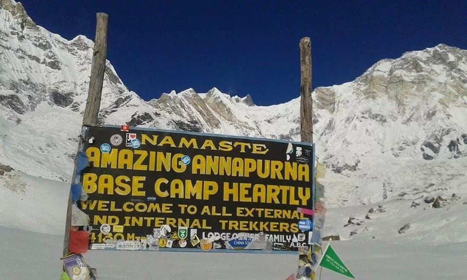
Annapurna, by comparison, had more amazing places along with mountains, landscapes, high hills, dense forests, lakes, and many other different natural beauty. This region is culturally and naturally rich. It was awesome how easy to follow and accessible it was for foreigners to trek without taking guide but with that came slightly less sense of adventure and resulted in spending more time with other westerners than locals. Not that that is a fault: it is more amazing in your own though and different experiences than other trekkers.
Additionally, the Annapurna region is not so remote than the Manaslu region. You can have both ways accessible roads from Jomsom (on the west side of Thorong La Pass) and Manang (on the east side of the pass). You can avoid these roads for hiking because this is dusty and polluted roads. The roads have also increased the tea house along the way providing western toilets, and different food menus. As getting Hot showers, electricity and Wi-Fi is not a big deal in the Annapurna region.
Every trek carries its features for attracting tourists. But in the case of Manaslu and Annapurna, we recommend both treks. This is because Manaslu offers you cultural and awesome trekking experience while Annapurna offers you an amazing view of mountains along with easy trekking trails. Also, Annapurna is best according to its feature. Both routes provides you awesome mountain views, had plenty of highs and minimal lows along with many cultural sites.
Manaslu Vs Annapurna Circuit Trek Summary Table
| Annapurna Circuit Trek | Manaslu Circuit Trek | |
| Start Point | Beshi Sahar | Arughat |
| End Point | Beni | Beshi Sahar |
| Max elevation | 5416 meters | 5167 meters |
| Independent trek | Allowed | Not allowed |
| Number of days | 14 to 22 days | 14 to 18 days |
| Ethnic Tribe | Gurung, Ghale, Manange & Thakali | Lama, Thakuri & Bhote |
| Accommodation | Well established Teahouses | Well established Teahouses |
| Food | Variety of menu and food | Variety of menu and food |
| Communication | NTC, Ncell and Landline phone | CDMA and V Sat Phone |
| Side trip | Tilicho Lake, Ice Lake, Gangapurna Lake & Nar Phu Valley | Serang Gompa, Hinang Gompa, Pungyen Gompa, Birendra Lake, Manaslu Base Camp & Tsum valley |
| Permit | ACAP & TIMS | ACAP, MCAP & Manaslu RAP |
| Access to flight | No | Yes |
| Best Trek Time | March-May & September-November | March-May & September-November |
| Access to Flight | Yes (Airport in Jomson & Manang | No |
| Medical Facility | Yes (Health Post in Manang & Jomsom) | No |
| Major river | Marsyangdi & Kaligandaki | Budhi Gandaki |
| Trails | Well-marked | Well-marked |
